Shuttle image of Red Sea & Sinai Peninsula
Numéro d’image : 11746459
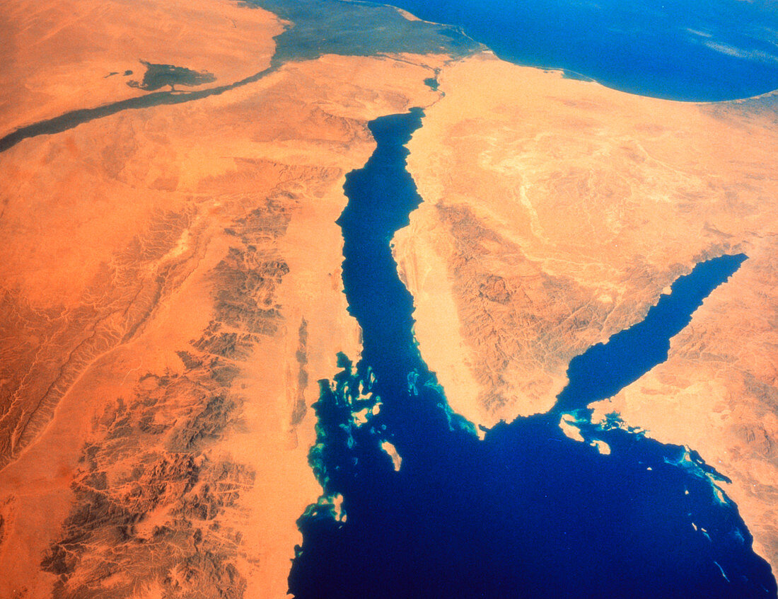
| Shuttle image of the Red Sea and the Sinai Peninsula (photographed on a Linhof camera with a 90mm lens),with Egypt and the Nile (& its delta) to the north and west,the Mediterranean Sea to the north,and Israel (north-east) and Saudi Arabia (east). The Red Sea divides into the Gulf of Suez (left),which ends in the Suez canal (seen running towards Port Said on eastern edge of the Nile Delta),and the Gulf of Aquaba (right). Between these waters is the Sinai Peninsula,with Mt. Sinai itself (Gebel Musa) prominent in the rocky mass at the bottom of the peninsula. KSC S 17120185 S Karl Esch (10x8) | |
| Licence : | Droits gérés |
| Crédit: | Science Photo Library / NASA |
| Taille de l’image : | 3642 px × 2801 px |
| Model Release : | Non requis |
| Property Release : | Non requis |
| Restrictions : | - |
Prix pour cette image À partir de 45 €
Produit vendu
(Calendrier, Carte postale, Carte de vœux, Impression sur textile, Packaging etc)
À partir de 45 €
Usage commercial
(Affichage, Annonce presse, Annonce TV, Carte, Digital - hors rés. sociaux, Digital - rés. sociaux etc)
À partir de 45 €
Éditorial
(Digital, Journal, Livre, Livre pratique, Magazine, Télévision etc)
À partir de 60 €
Usage non-commercial
(Digital - hors rés. sociaux, Digital - rés. sociaux etc)
À partir de 120 €