Hawaiian islands,topographical map
Numéro d’image : 11746403
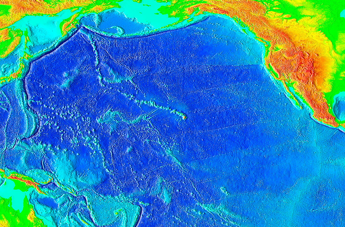
| Hawaii island chain,topographical map. Elevation is colour-coded. On land,low-lying areas are green,with yellow,orange and red indicating increasing elevation. In the ocean,shallow areas of continental shelf are turquoise,with deeper blues showing deeper regions. The Hawaiian island chain stretches for some 2400 kilometres northwest of Hawaii (the largest island). This island contains two huge volcanoes,Mauna Kea and Mauna Loa,which stand over four kilometres high. The chain formed as the Pacific tectonic plate slowly moved northwestwards over a stationary hotspot. The hotspot is a region where hot mantle material erupts through the crust,forming volcanoes | |
| Licence : | Droits gérés |
| Crédit: | Science Photo Library / NOAA |
| Taille de l’image : | 4044 px × 2658 px |
| Model Release : | Non requis |
| Property Release : | Non requis |
| Restrictions : |
|
Prix pour cette image À partir de 45 €
Produit vendu
(Calendrier, Carte postale, Carte de vœux, Impression sur textile, Packaging etc)
À partir de 45 €
Usage commercial
(Affichage, Annonce presse, Annonce TV, Carte, Digital - hors rés. sociaux, Digital - rés. sociaux etc)
À partir de 45 €
Éditorial
(Digital, Journal, Livre, Livre pratique, Magazine, Télévision etc)
À partir de 60 €
Usage non-commercial
(Digital - hors rés. sociaux, Digital - rés. sociaux etc)
À partir de 120 €
Mots clés
- américain,
- bathymétrie,
- chaîne,
- environnement,
- étagère,
- Etats-Unis,
- fond de la mer,
- fond marin,
- fond sous-marin,
- fonds marins,
- géographie,
- géographique,
- géologie,
- géologique,
- Hawaï,
- Hawai'i,
- Hawaii,
- île,
- îles,
- Mauna Kea,
- mauna Loa,
- N/A,
- Océan Pacifique,
- plaque continental,
- point chaud,
- tectonique des plaques,
- topographie,
- topographique,
- tropical,
- US,
- USA,
- volcanique,
- zone de tension,
- zone sensible