Bay of Mont St. Michel,France
Numéro d’image : 11745145
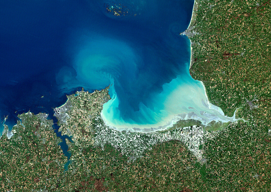
| Bay of Mont Saint-Michel,France,satellite image. North is at top. Vegetation is shown in green,water in blue,and urban areas in grey. This bay lies in the north-western corner of the Basse-Normandie region in northern France. To the east is the estuary of the rivers Couesnon,See and Selune. The bay takes its name from Le Mont Saint-Michel,a small rocky island in the Couesnon part of the estuary lying about 1 kilometre from the northern coastline (just visible here as the lower of the two dark dots) | |
| Licence : | Droits gérés |
| Crédit: | Science Photo Library / Planetobserver |
| Taille de l’image : | 4961 px × 3508 px |
| Model Release : | Non requis |
| Property Release : | Non requis |
| Restrictions : | - |
Prix pour cette image À partir de 45 €
Produit vendu
(Calendrier, Carte postale, Carte de vœux, Impression sur textile, Packaging etc)
À partir de 45 €
Usage commercial
(Affichage, Annonce presse, Annonce TV, Carte, Digital - hors rés. sociaux, Digital - rés. sociaux etc)
À partir de 45 €
Éditorial
(Digital, Journal, Livre, Livre pratique, Magazine, Télévision etc)
À partir de 60 €
Usage non-commercial
(Digital - hors rés. sociaux, Digital - rés. sociaux etc)
À partir de 120 €
Mots clés
- baie,
- BASSE-NORMANDIE,
- caractéristique géographique,
- côte,
- côtier,
- de l'espace,
- estuaire,
- estuaires,
- Europe,
- européen,
- français,
- France,
- géographie,
- géographique,
- île,
- îles,
- image satellite,
- littoral,
- Manche,
- Mont Saint Michel,
- Mont St Michel,
- Normandie,
- observation de la terre,
- rivières,
- saint,
- satellite,
- science de la terre,
- sciences,
- st.,
- terre,
- voir