Nile Delta and Sinai Peninsula from space
Numéro d’image : 11745092
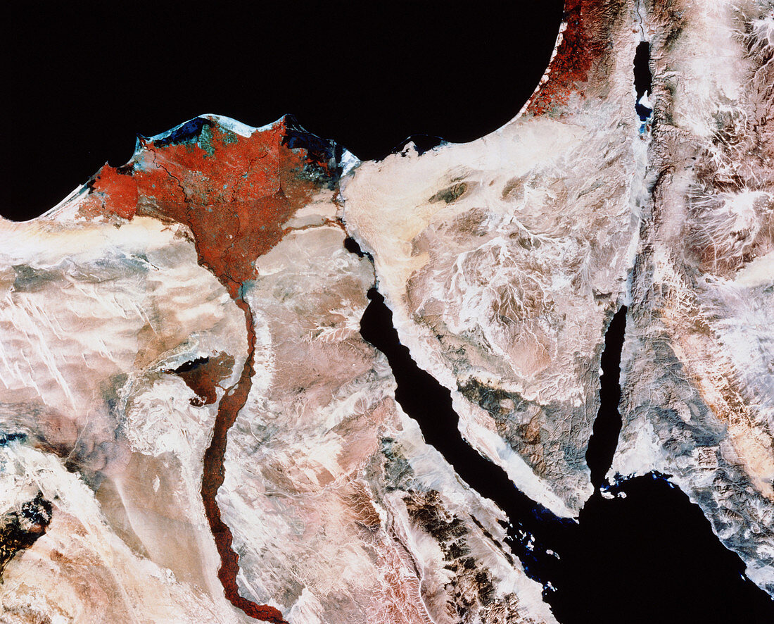
| Nile delta. Coloured LANDSAT satellite image of the Nile delta,Egypt,and surrounding regions. North is at top. Photographed in the infrared range,the red colour reveals agriculture in the fertile delta region (upper left),along the Nile river (lower left),and in Israel (upper right). The city of Cairo is the dark grey area at the base of the delta,with blue lagoons at the face of the delta. At upper centre is the Suez Canal running from the Mediterranean Sea (at top) to the Red Sea (centre). The Sinai is the triangular body of land at centre right,with the Dead Sea (black) in Israel at top right. The landscape is desert | |
| Licence : | Droits gérés |
| Crédit: | Science Photo Library / MDA Information Systems |
| Taille de l’image : | 4208 px × 3391 px |
| Model Release : | Non requis |
| Property Release : | Non requis |
| Restrictions : | - |
Prix pour cette image À partir de 45 €
Produit vendu
(Calendrier, Carte postale, Carte de vœux, Impression sur textile, Packaging etc)
À partir de 45 €
Usage commercial
(Affichage, Annonce presse, Annonce TV, Carte, Digital - hors rés. sociaux, Digital - rés. sociaux etc)
À partir de 45 €
Éditorial
(Digital, Journal, Livre, Livre pratique, Magazine, Télévision etc)
À partir de 60 €
Usage non-commercial
(Digital - hors rés. sociaux, Digital - rés. sociaux etc)
À partir de 120 €