Niagara Falls
Numéro d’image : 11745045
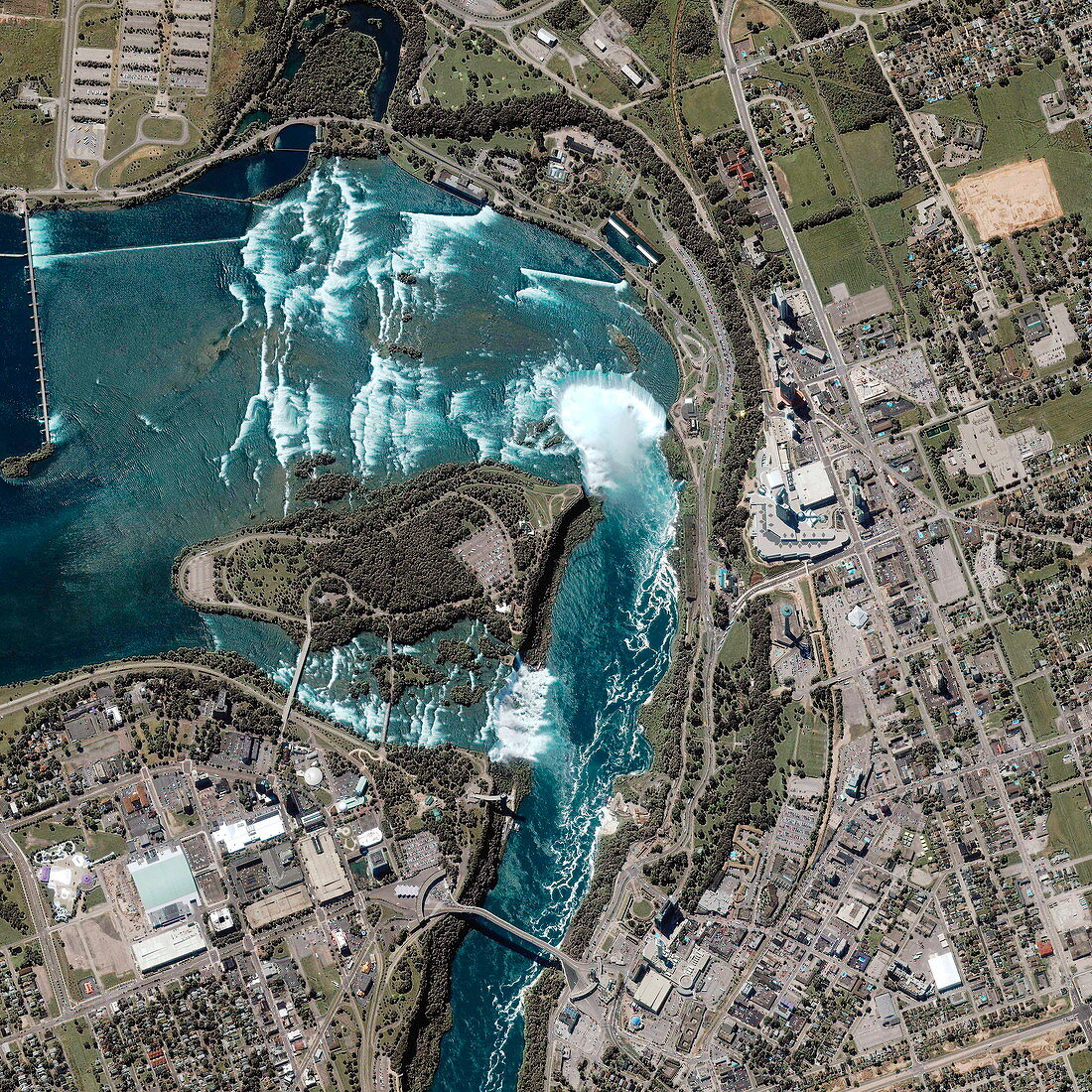
| Niagara Falls. Satellite image of Niagara falls,a complex of waterfalls in the Niagara River. The Niagara River forms the American (bottom)-Canadian (top) border and allows Lake Erie to drain into Lake Ontario. The waterfall complex is made up of the American Falls (lower centre,328 metres wide) and the Horseshoe Falls (upper centre,675 metres wide). Both are around 50 metres high. Millions of litres of water flow over the falls every second,eroding the rock and powering hydroelectric power plants further downstream | |
| Licence : | Droits gérés |
| Crédit: | Science Photo Library / Geoeye |
| Taille de l’image : | 3000 px × 3000 px |
| Model Release : | Non requis |
| Property Release : | Non requis |
| Restrictions : | - |
Prix pour cette image À partir de 45 €
Produit vendu
(Calendrier, Carte postale, Carte de vœux, Impression sur textile, Packaging etc)
À partir de 45 €
Usage commercial
(Affichage, Annonce presse, Annonce TV, Carte, Digital - hors rés. sociaux, Digital - rés. sociaux etc)
À partir de 45 €
Éditorial
(Digital, Journal, Livre, Livre pratique, Magazine, Télévision etc)
À partir de 60 €
Usage non-commercial
(Digital - hors rés. sociaux, Digital - rés. sociaux etc)
À partir de 120 €