Mont Blanc,satellite image
Numéro d’image : 11744679
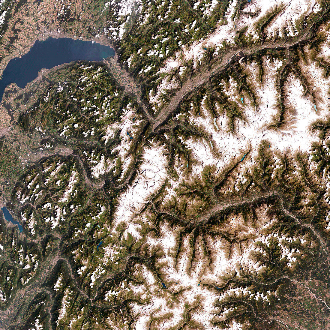
| Mont Blanc,satellite image. North is at top. Mont Blanc (centre) is western Europe's highest mountain,at 4807 metres tall. The large body of water at upper left is Lake Geneva in Switzerland. Mont Blanc itself lies on the French-Italian border,with France to the west (left) and Italy to the east. The Alps,of which Mont Blanc is a part,is a mountain range formed over the last 100 million years by the northward movement of the African tectonic plate relative to the Eurasian plate. This image was taken by the Enhanced Thematic Mapper Plus (ETM+) on the Landsat 7 satellite on July 30th 2001 | |
| Licence : | Droits gérés |
| Crédit: | Science Photo Library / NASA |
| Taille de l’image : | 4000 px × 4000 px |
| Model Release : | Non requis |
| Property Release : | Non requis |
| Restrictions : | - |
Prix pour cette image À partir de 45 €
Produit vendu
(Calendrier, Carte postale, Carte de vœux, Impression sur textile, Packaging etc)
À partir de 45 €
Usage commercial
(Affichage, Annonce presse, Annonce TV, Carte, Digital - hors rés. sociaux, Digital - rés. sociaux etc)
À partir de 45 €
Éditorial
(Digital, Journal, Livre, Livre pratique, Magazine, Télévision etc)
À partir de 60 €
Usage non-commercial
(Digital - hors rés. sociaux, Digital - rés. sociaux etc)
À partir de 120 €
Mots clés
- Alpes,
- alpin,
- appareil de cartographie thématique amélioré,
- Enhanced Thematic Mapper Plus,
- environnement,
- ETM+,
- Europe,
- européen,
- français,
- France,
- géographie,
- image satellite,
- imagerie,
- Landsat,
- Léman,
- Mont Blanc,
- Mont-Blanc,
- montagne,
- montagnes,
- observation de la terre,
- Rhône,
- rivière,
- vallée,
- vallées