Volcano distribution map
Numéro d’image : 11740744
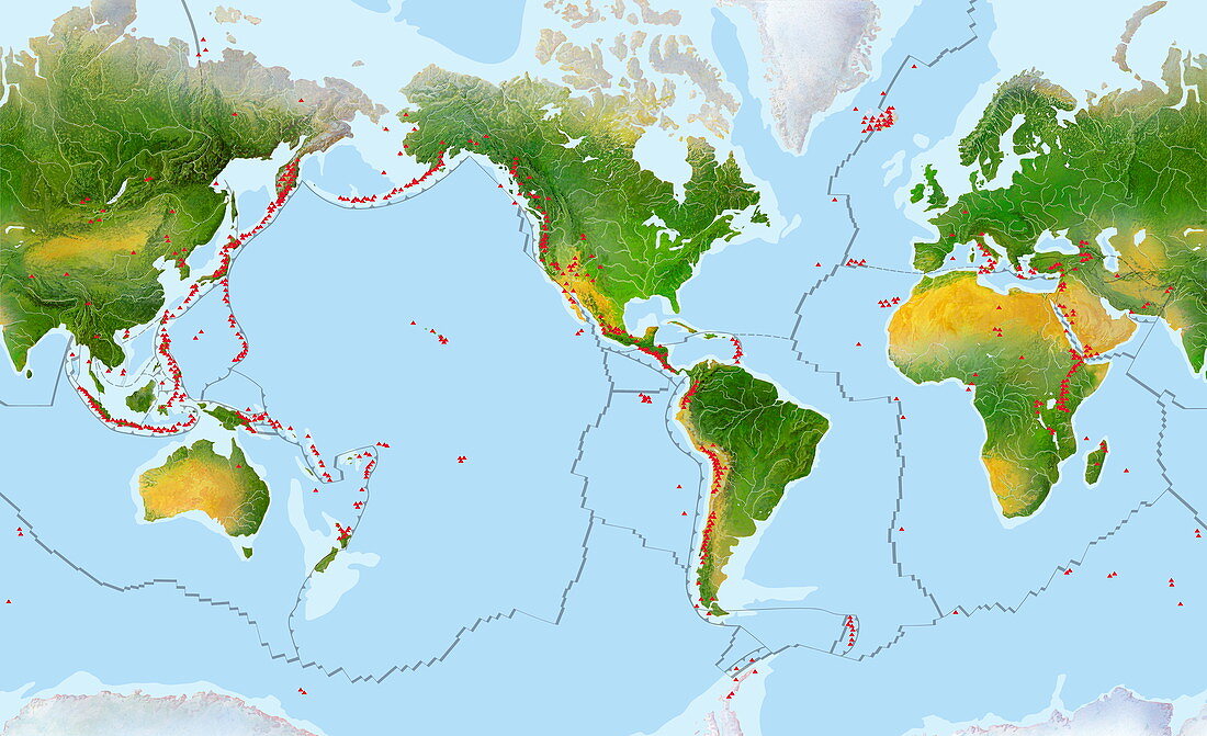
| Volcano distribution map. Locations of volcanoes are shown by red dots. The grey lines are the boundaries between the Earth's tectonic plates,and the map shows the correlation between the two. Volcanoes are regions where magma from deep in the Earth comes to the surface. This is most common at subduction zones,where one plate is forced beneath another as they collide. This process heats the plates by friction,melting the crust to magma,which then rises through the overlying crust to be released. They also occur where plates spread apart,as in the mid-Atlantic and Iceland. Sometimes there is a hotspot unassociated with a plate margin (for instance Hawaii) | |
| Licence : | Droits gérés |
| Crédit: | Science Photo Library / Hks, Gary |
| Taille de l’image : | 6002 px × 3662 px |
| Model Release : | Non requis |
| Property Release : | Non requis |
| Restrictions : | - |
Prix pour cette image À partir de 45 €
Produit vendu
(Calendrier, Carte postale, Carte de vœux, Impression sur textile, Packaging etc)
À partir de 45 €
Usage commercial
(Affichage, Annonce presse, Annonce TV, Carte, Digital - hors rés. sociaux, Digital - rés. sociaux etc)
À partir de 45 €
Éditorial
(Digital, Journal, Livre, Livre pratique, Magazine, Télévision etc)
À partir de 60 €
Usage non-commercial
(Digital - hors rés. sociaux, Digital - rés. sociaux etc)
À partir de 120 €
Mots clés
- carte,
- collision,
- continent,
- continents,
- déplacement,
- déplacer,
- dérive des continents,
- distribution,
- frontière,
- frontières,
- géographie,
- géographique,
- géologie,
- géologique,
- illustration,
- limite,
- limites,
- monde,
- mouvement,
- oeuvre,
- plaque tectonique,
- plaques,
- plats,
- régions,
- secteurs,
- subduction,
- tectonique des plaques,
- terre,
- tremblement de terre,
- volcan,
- volcans,
- zone,
- zones