Chesapeake and Delaware Bays,USA
Numéro d’image : 11739918
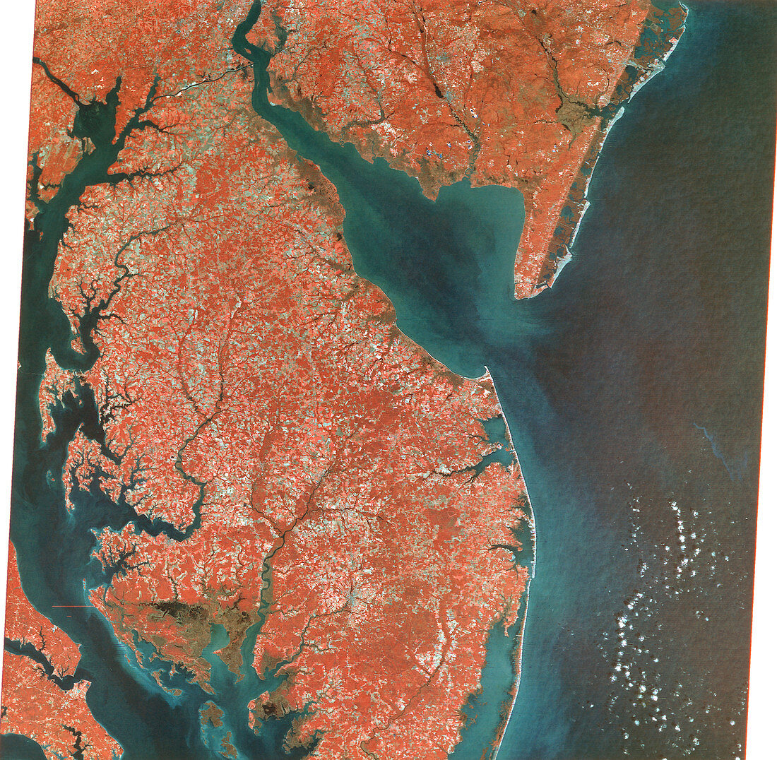
| Chesapeake and Delaware Bays,USA,combined visible and infrared satellite image. North is at top. Chesapeake (down left) and Delaware (upper centre) Bays are inlets of the Atlantic Ocean (blue),and are surrounded by the states of Virginia (bottom left),Delaware (centre),Maryland (centre left to bottom left) and New Jersey (upper right). Vegetation is red and clouds are white. Photographed by Landsat 1 on 10th October 1972 | |
| Licence : | Droits gérés |
| Crédit: | Science Photo Library / MDA Information Systems |
| Taille de l’image : | 5013 px × 4902 px |
| Model Release : | Non requis |
| Property Release : | Non requis |
| Restrictions : | - |
Prix pour cette image À partir de 45 €
Produit vendu
(Calendrier, Carte postale, Carte de vœux, Impression sur textile, Packaging etc)
À partir de 45 €
Usage commercial
(Affichage, Annonce presse, Annonce TV, Carte, Digital - hors rés. sociaux, Digital - rés. sociaux etc)
À partir de 45 €
Éditorial
(Digital, Journal, Livre, Livre pratique, Magazine, Télévision etc)
À partir de 60 €
Usage non-commercial
(Digital - hors rés. sociaux, Digital - rés. sociaux etc)
À partir de 120 €
Mots clés
- admission,
- américain,
- Baie de Chesapeake,
- baie de la Delaware,
- côte,
- Côte Est,
- côtes,
- côtier,
- de l'espace,
- entrée,
- Etats-Unis,
- géographie,
- image satellite,
- imagerie,
- infrarouge,
- Landsat,
- littoral,
- littoraux,
- Maryland,
- mer,
- New Jersey,
- observation de la terre,
- Océan Atlantique,
- rivière,
- rivières,
- USA,
- Virginie