Hurricane Rita,satellite image
Numéro d’image : 11738056
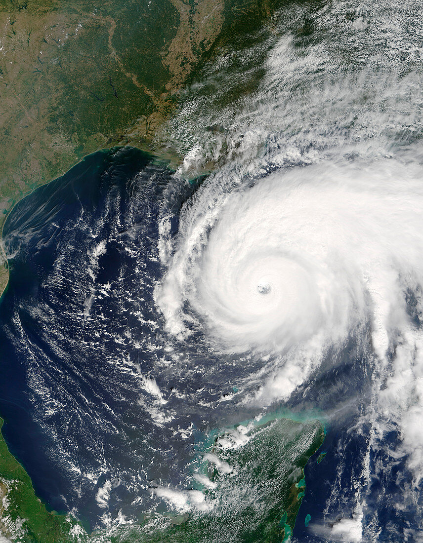
| Hurricane Rita. Terra satellite image of Hurricane Rita over the Gulf of Mexico at 16:55 UTC on 22nd September 2005. North is at top. Hurricane Rita formed north-east of Cuba (not seen) from 18th September,and moved west into the Gulf of Mexico,reaching Category 5 strength on 21st September. From here,It moved north-west,heading towards Houston,Texas,USA (upper left). The US mainland is seen across top,and parts of Mexico are at lower left. Rita is the ninth hurricane of the 2005 Atlantic hurricane season,and among the most intense ever. It formed only a few weeks after Hurricane Katrina devastated the Louisiana and Mississippi coastline (upper centre) | |
| Licence : | Droits gérés |
| Crédit: | Science Photo Library / NASA |
| Taille de l’image : | 4800 px × 6171 px |
| Model Release : | Non requis |
| Property Release : | Non requis |
| Restrictions : | - |
Prix pour cette image À partir de 45 €
Produit vendu
(Calendrier, Carte postale, Carte de vœux, Impression sur textile, Packaging etc)
À partir de 45 €
Usage commercial
(Affichage, Annonce presse, Annonce TV, Carte, Digital - hors rés. sociaux, Digital - rés. sociaux etc)
À partir de 45 €
Éditorial
(Digital, Journal, Livre, Livre pratique, Magazine, Télévision etc)
À partir de 60 €
Usage non-commercial
(Digital - hors rés. sociaux, Digital - rés. sociaux etc)
À partir de 120 €