Tropical Cyclone Hary
Numéro d’image : 11737986
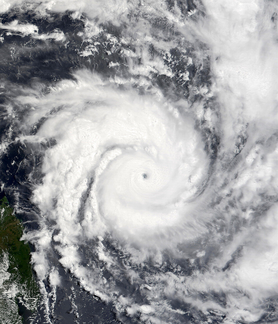
| Tropical Cyclone Hary. Satellite image of Tropical Cyclone Hary approaching the coast of Madagascar. The storm affected the northern and eastern shores of Madagascar. At the time this image was taken,the cyclone was producing winds of up to 269 kilometres per hour. Photographed in March 2002 by the Moderate-resolution Imaging Spectroradiometer (MODIS) instrument aboard NASA's Terra spacecraft | |
| Licence : | Droits gérés |
| Crédit: | Science Photo Library / NASA |
| Taille de l’image : | 3000 px × 3500 px |
| Model Release : | Non requis |
| Property Release : | Non requis |
| Restrictions : | - |
Prix pour cette image À partir de 45 €
Produit vendu
(Calendrier, Carte postale, Carte de vœux, Impression sur textile, Packaging etc)
À partir de 45 €
Usage commercial
(Affichage, Annonce presse, Annonce TV, Carte, Digital - hors rés. sociaux, Digital - rés. sociaux etc)
À partir de 45 €
Éditorial
(Digital, Journal, Livre, Livre pratique, Magazine, Télévision etc)
À partir de 60 €
Usage non-commercial
(Digital - hors rés. sociaux, Digital - rés. sociaux etc)
À partir de 120 €