Infrared NOAA image of 1991 typhoon,Bangladesh
Numéro d’image : 11737951
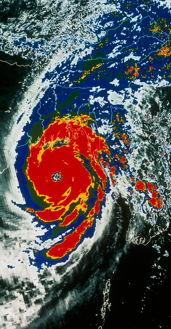
| Typhoon. Colour-enhanced infrared NOAA satellite image of a typhoon (tropical cyclone) approaching the coast of Bangladesh in 1991. North is towards the top. The outline of the coast of Bangladesh is superimposed as fine white lines. This typhoon is colour-coded to cloud reflectance which relates to cloud density: red (high),through yellow,green to blue (low). Typhoons (like hurricanes) are huge,revolving,tropical storms in which ferocious winds over 200 km per hour spiral around a central,calm,low pressure area called the eye. Often accompanied by torrential rain,they can cause extensive damage when they cross land | |
| Licence : | Droits gérés |
| Crédit: | Science Photo Library / MDA Information Systems |
| Taille de l’image : | 2480 px × 4766 px |
| Model Release : | Non requis |
| Property Release : | Non requis |
| Restrictions : | - |
Prix pour cette image À partir de 45 €
Produit vendu
(Calendrier, Carte postale, Carte de vœux, Impression sur textile, Packaging etc)
À partir de 45 €
Usage commercial
(Affichage, Annonce presse, Annonce TV, Carte, Digital - hors rés. sociaux, Digital - rés. sociaux etc)
À partir de 45 €
Éditorial
(Digital, Journal, Livre, Livre pratique, Magazine, Télévision etc)
À partir de 60 €
Usage non-commercial
(Digital - hors rés. sociaux, Digital - rés. sociaux etc)
À partir de 120 €