Colour satellite image of atmospheric water vapour
Numéro d’image : 11736354
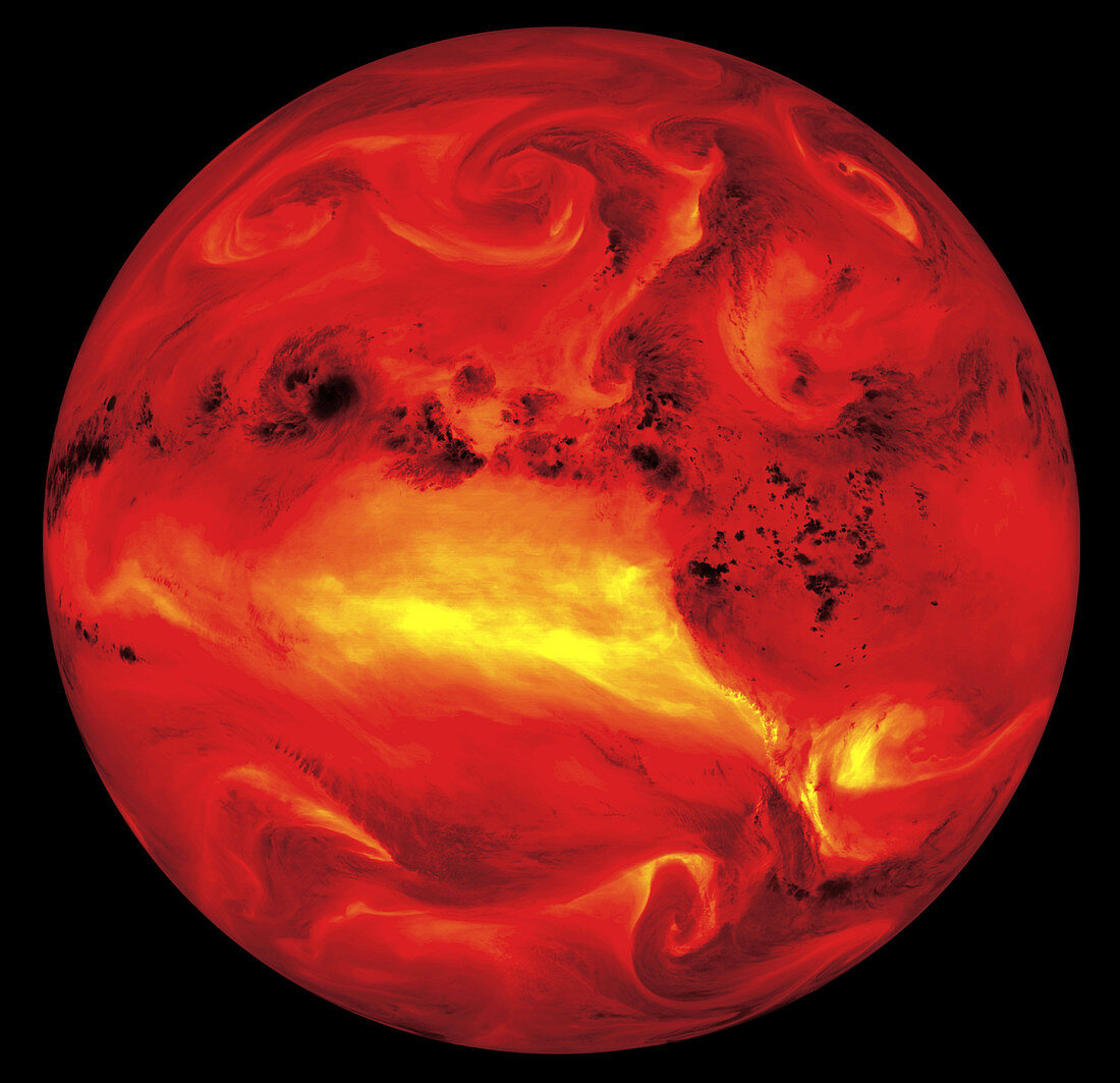
| Atmospheric water vapour. Coloured infrared satellite image of the whole Earth,showing upper atmospheric water vapour (yellow). North is at top. The central yellow area marks a dense area of water vapour evaporated by powerful equatorial solar radiation. Sub-tropical storms (black,northern hemisphere) return this water to the Earth's surface as rain. Their thick clouds (water droplets) absorb radiation at this wavelength (6.7 microns). There are advective weather systems (yellow swirls) in the temperate latitudes of both hemispheres. This image was taken by the American GOES-8 satellite on 23 September 1994 | |
| Licence : | Droits gérés |
| Crédit: | Science Photo Library / NASA's Goddard Space Flight Center |
| Taille de l’image : | 2950 px × 2850 px |
| Model Release : | Non requis |
| Property Release : | Non requis |
| Restrictions : | - |
Prix pour cette image À partir de 45 €
Produit vendu
(Calendrier, Carte postale, Carte de vœux, Impression sur textile, Packaging etc)
À partir de 45 €
Usage commercial
(Affichage, Annonce presse, Annonce TV, Carte, Digital - hors rés. sociaux, Digital - rés. sociaux etc)
À partir de 45 €
Éditorial
(Digital, Journal, Livre, Livre pratique, Magazine, Télévision etc)
À partir de 60 €
Usage non-commercial
(Digital - hors rés. sociaux, Digital - rés. sociaux etc)
À partir de 120 €