France from space
Numéro d’image : 11736033
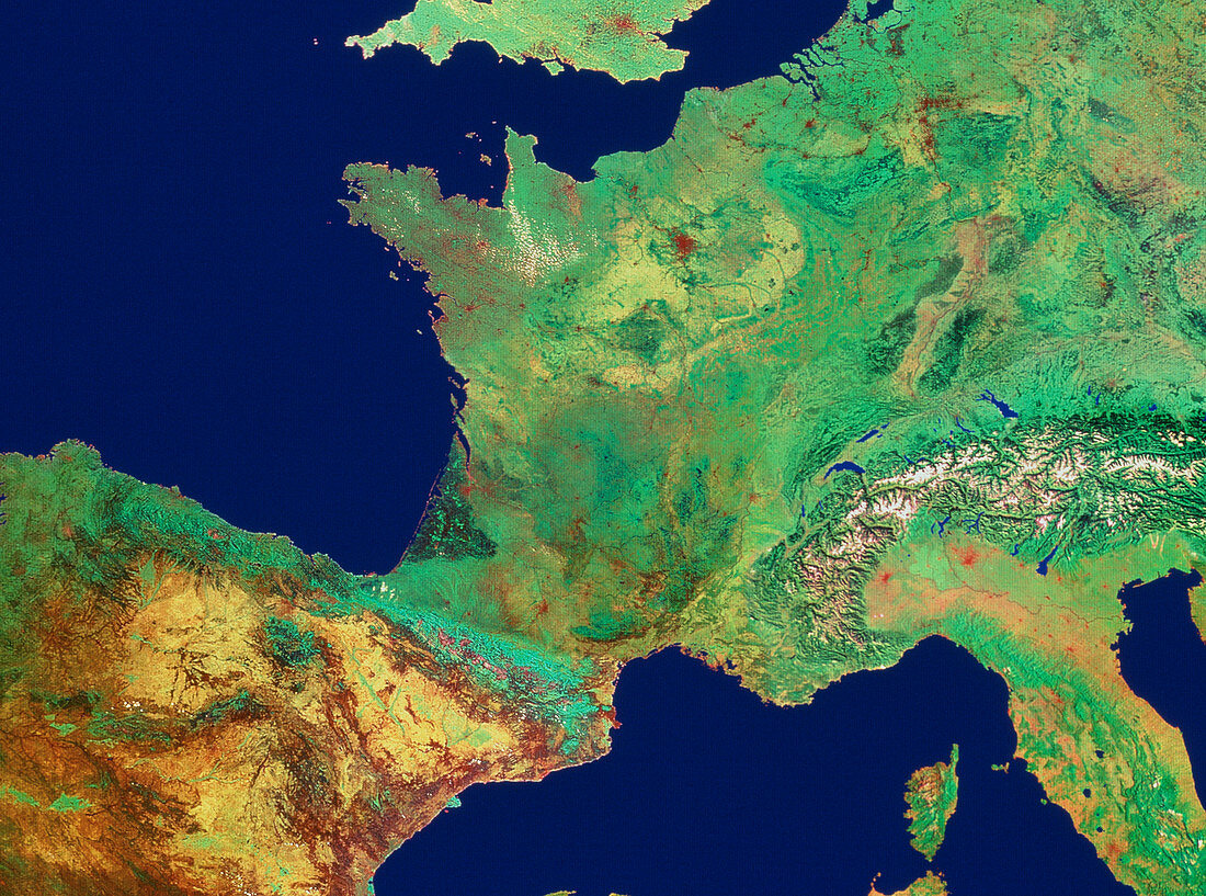
| France,seen from space. Mosaic of satellite images showing France and its neighbours in western Europe. The colours of this image have been processed to approximate to natural tones. France is bordered by several countries,including Spain (yellow,bottom left),Belgium (upper right),Luxembourg and Germany (right),Switzerland (centre right,in the Alps) and Italy (lower right). At top centre is southern England. The island of Corsica (bottom right) is also under French administration. The capital of France,Paris,is seen as the brown spot directly above centre. The data for this image were gathered by NOAA weather satellites | |
| Licence : | Droits gérés |
| Crédit: | Science Photo Library / Geospace |
| Taille de l’image : | 4318 px × 3208 px |
| Model Release : | Non requis |
| Property Release : | Non requis |
| Restrictions : | - |
Prix pour cette image À partir de 45 €
Produit vendu
(Calendrier, Carte postale, Carte de vœux, Impression sur textile, Packaging etc)
À partir de 45 €
Usage commercial
(Affichage, Annonce presse, Annonce TV, Carte, Digital - hors rés. sociaux, Digital - rés. sociaux etc)
À partir de 45 €
Éditorial
(Digital, Journal, Livre, Livre pratique, Magazine, Télévision etc)
À partir de 60 €
Usage non-commercial
(Digital - hors rés. sociaux, Digital - rés. sociaux etc)
À partir de 120 €
Mots clés
- Alpes,
- Bavière,
- Belgique,
- Bretagne,
- CORSICA,
- COTE D'AZUR,
- de l'espace,
- état,
- France,
- géographie,
- golfe de Gascogne,
- image de Noaa,
- image satellite,
- imagerie satellitaire,
- imagerie satellite,
- images du satellite Noaa,
- Lombardie,
- nation,
- nations,
- Normandie,
- Paris,
- pays,
- Provence,
- science de la terre,
- sciences,
- Suisse