Satellite image of the Arabian Peninsula
Numéro d’image : 11735714
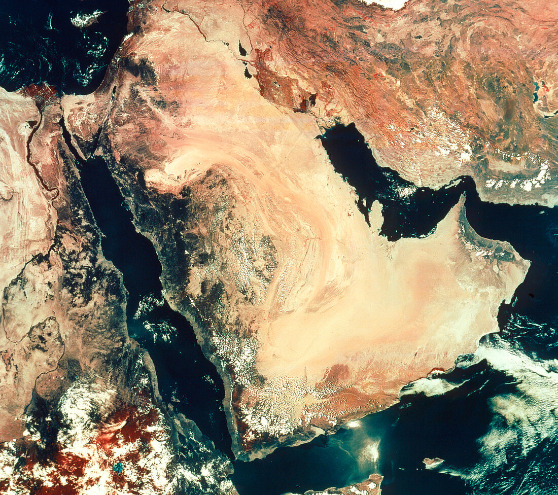
| Arabian Peninsula. Infrared satellite image of the Arabian Peninsula and Asia minor. North is at top. In the infrared range,vegetation appears red,water is black,cloud is white,bare ground and desert is in shades of brown. At centre is the Arabian Peninsula largely comprising Saudi Arabia,bordered by the Red Sea (lower left) and Persian Gulf (centre right). The Arabian Peninsula is mainly sandy and rocky desert. The Mediterranean Sea is at top left with the island of Cyprus seen; the Caspian Sea is partly dried out (top right,white). Iran is at upper right. Africa is at left frame,with the Nile river and delta visible | |
| Licence : | Droits gérés |
| Crédit: | Science Photo Library / MDA Information Systems |
| Taille de l’image : | 3134 px × 2780 px |
| Model Release : | Non requis |
| Property Release : | Non requis |
| Restrictions : | - |
Prix pour cette image À partir de 45 €
Produit vendu
(Calendrier, Carte postale, Carte de vœux, Impression sur textile, Packaging etc)
À partir de 45 €
Usage commercial
(Affichage, Annonce presse, Annonce TV, Carte, Digital - hors rés. sociaux, Digital - rés. sociaux etc)
À partir de 45 €
Éditorial
(Digital, Journal, Livre, Livre pratique, Magazine, Télévision etc)
À partir de 60 €
Usage non-commercial
(Digital - hors rés. sociaux, Digital - rés. sociaux etc)
À partir de 120 €