South America
Numéro d’image : 11735707
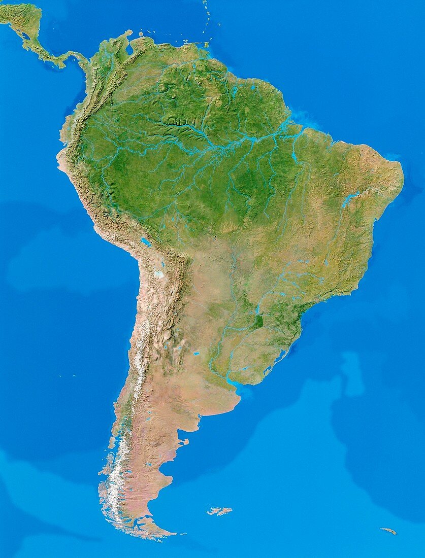
| South America. Cloudless satellite image of the continent of South America. North is at top. The colours of the land approximate to natural tones,whilst blue colour-codes represent ocean topography. Along South America's western edge are the Andes Mountains. The continent's largest river is the Amazon (at upper centre) which drains a large area of tropical rainforest. This image was comp- iled from data acquired by NOAA weather satellites over eleven ten-day periods at an altitude of 833 kilometres to give a resolution of 1 kilometre | |
| Licence : | Droits gérés |
| Crédit: | Science Photo Library / PLANETARY VISIONS / TOM VAN SANT, GEOSPHERE PROJECT |
| Taille de l’image : | 3217 px × 4227 px |
| Model Release : | Non requis |
| Property Release : | Non requis |
| Restrictions : |
|
Prix pour cette image À partir de 45 €
Produit vendu
(Calendrier, Carte postale, Carte de vœux, Impression sur textile, Packaging etc)
À partir de 45 €
Usage commercial
(Affichage, Annonce presse, Annonce TV, Carte, Digital - hors rés. sociaux, Digital - rés. sociaux etc)
À partir de 45 €
Éditorial
(Digital, Journal, Livre, Livre pratique, Magazine, Télévision etc)
À partir de 60 €
Usage non-commercial
(Digital - hors rés. sociaux, Digital - rés. sociaux etc)
À partir de 120 €