Newfoundland and the Great Lakes
Numéro d’image : 11735672
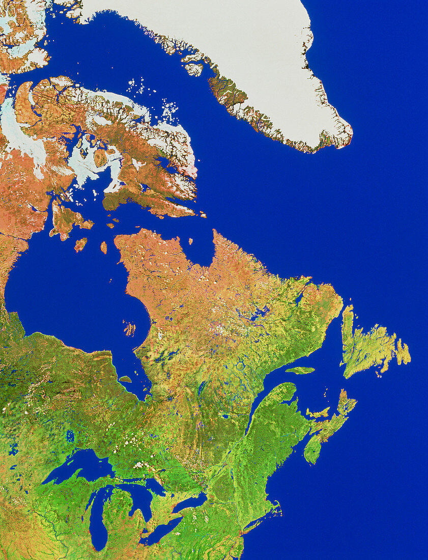
| Eastern Canada. Mosaic of satellite images showing the eastern provinces of Canada. In the centre of the frame is Quebec,bordered by Hudson Bay at left and the Gulf of St.Lawrence at right. The northern coast of this peninsula,and the island to the right,make up Newfoundland. Between the Great Lakes at bottom left and Hudson Bay is the province of Ontario. At upper left are ice-locked islands in the Northern Territories. At top centre is ice-covered Greenland. Land along the bottom of the frame is in the USA. The data for this image were gathered by NOAA weather satellites | |
| Licence : | Droits gérés |
| Crédit: | Science Photo Library / Worldsat International |
| Taille de l’image : | 3684 px × 4819 px |
| Model Release : | Non requis |
| Property Release : | Non requis |
| Restrictions : |
|
Prix pour cette image À partir de 45 €
Produit vendu
(Calendrier, Carte postale, Carte de vœux, Impression sur textile, Packaging etc)
À partir de 45 €
Usage commercial
(Affichage, Annonce presse, Annonce TV, Carte, Digital - hors rés. sociaux, Digital - rés. sociaux etc)
À partir de 45 €
Éditorial
(Digital, Journal, Livre, Livre pratique, Magazine, Télévision etc)
À partir de 60 €
Usage non-commercial
(Digital - hors rés. sociaux, Digital - rés. sociaux etc)
À partir de 120 €