GeoSphere image of Europe with airglow horizon
Numéro d’image : 11735657
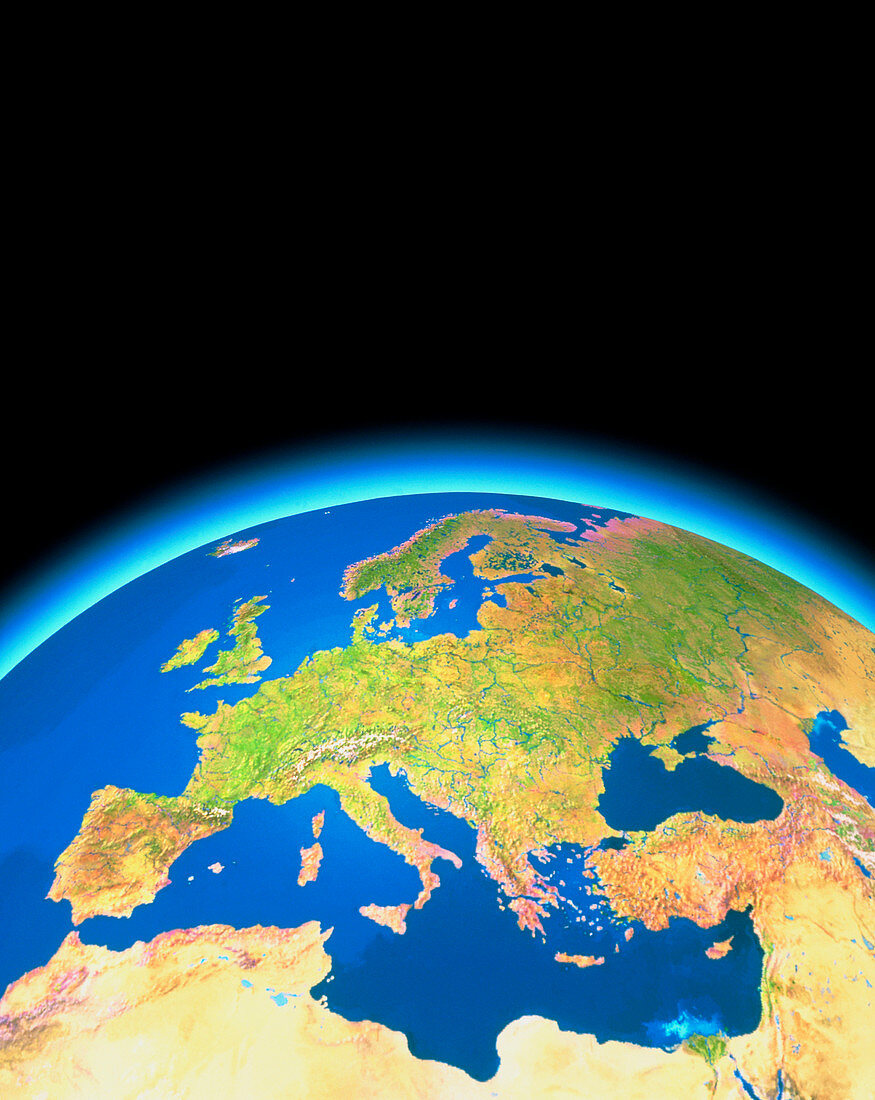
| Europe and North Africa. Satellite mosaic image of Europe and the Mediterranean Sea. The colours in the land represent natural tones. Most of Europe appears green denoting the abundant vegetation. In extreme northern latitudes,the pale purple of the tundra is seen,whilst in southern Europe harsher,semi-arid soils are seen as brown. The deserts of northern Africa and the Middle East are shown in pale brown. River courses have been emphasised for clarity. This image was created from a database of thousands of images of the Earth made by NOAA weather satellites | |
| Licence : | Droits gérés |
| Crédit: | Science Photo Library / GEOSPHERE PROJECT, SANTA MONICA / COPYRIGHT TOM VAN SANT |
| Taille de l’image : | 3599 px × 4525 px |
| Model Release : | Non requis |
| Property Release : | Non requis |
| Restrictions : |
|
Prix pour cette image À partir de 45 €
Produit vendu
(Calendrier, Carte postale, Carte de vœux, Impression sur textile, Packaging etc)
À partir de 45 €
Usage commercial
(Affichage, Annonce presse, Annonce TV, Carte, Digital - hors rés. sociaux, Digital - rés. sociaux etc)
À partir de 45 €
Éditorial
(Digital, Journal, Livre, Livre pratique, Magazine, Télévision etc)
À partir de 60 €
Usage non-commercial
(Digital - hors rés. sociaux, Digital - rés. sociaux etc)
À partir de 120 €