Eastern Canada mosaic
Numéro d’image : 11735654
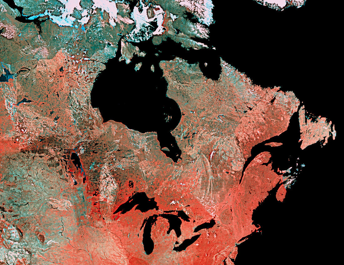
| Eastern Canada. Mosaic of satellite images showing the eastern half of Canada. The colours of this image have been processed to reveal surface vegetation. Dark olive green (top left) is arctic tundra. A band of lighter grey-green across the frame indicates boreal forest,whilst the redder area at lower centre indicates mixed mid-latitude forest. The blue-grey area at lower left is prairie. The Great Lakes are seen at lower centre. Just above centre is Hudson Bay. At the very top of the frame are areas of permanent sea ice in the Arctic. At top right is the tip of Greenland. The mosaic was made from NOAA weather satellite data | |
| Licence : | Droits gérés |
| Crédit: | Science Photo Library / MDA Information Systems |
| Taille de l’image : | 4823 px × 3708 px |
| Model Release : | Non requis |
| Property Release : | Non requis |
| Restrictions : | - |
Prix pour cette image À partir de 45 €
Produit vendu
(Calendrier, Carte postale, Carte de vœux, Impression sur textile, Packaging etc)
À partir de 45 €
Usage commercial
(Affichage, Annonce presse, Annonce TV, Carte, Digital - hors rés. sociaux, Digital - rés. sociaux etc)
À partir de 45 €
Éditorial
(Digital, Journal, Livre, Livre pratique, Magazine, Télévision etc)
À partir de 60 €
Usage non-commercial
(Digital - hors rés. sociaux, Digital - rés. sociaux etc)
À partir de 120 €