North America
Numéro d’image : 11735636
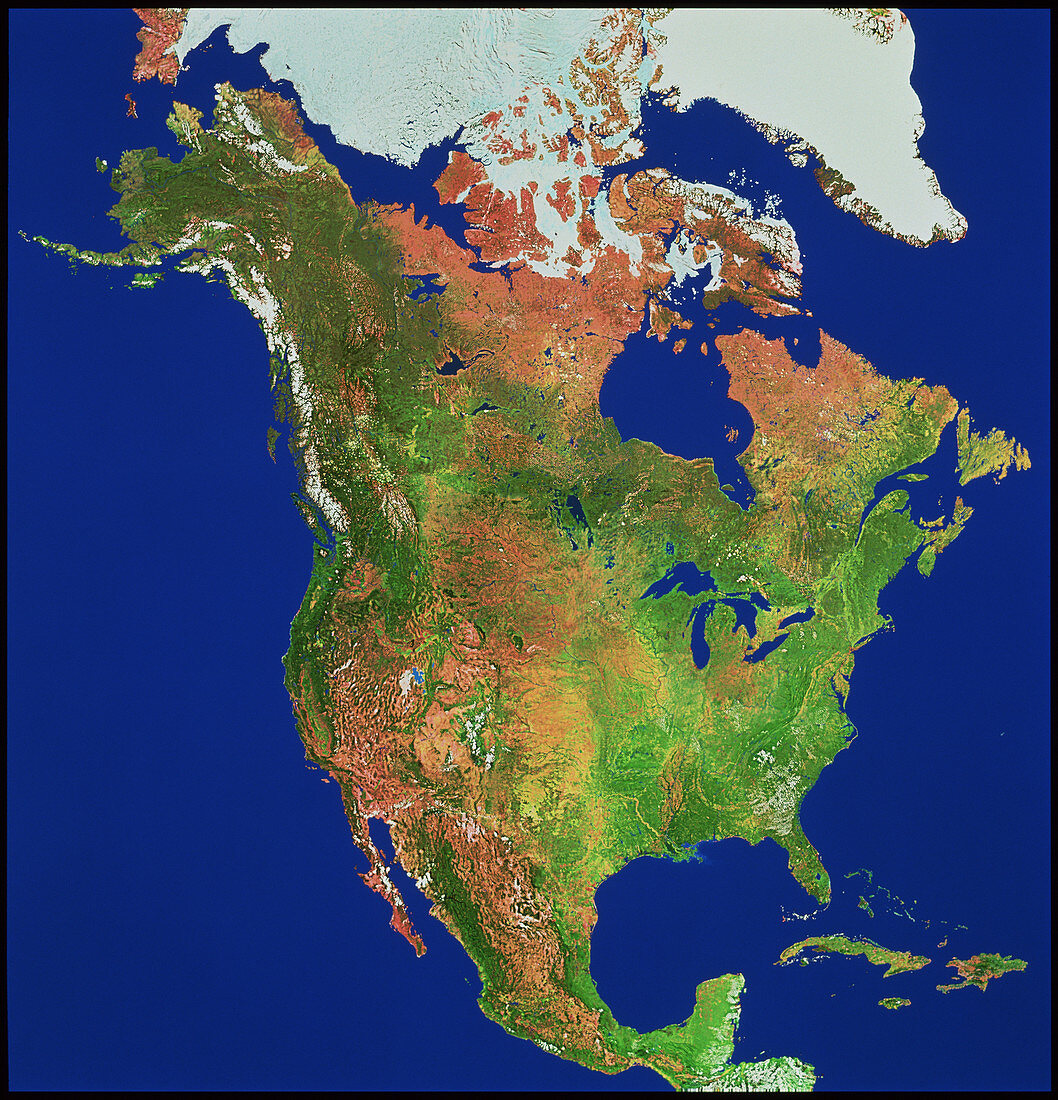
| A mosaic of Landsat satellite images of North America. This image shows the main geographical areas of the continent. Dark green represents coniferous vegetation,seen in the north-west and in a belt extending to the Great Lakes in the east. Above this belt is brown Arctic tundra and white permanent ice,with Greenland at top right. Below the coniferous belt are the mottled-brown high deserts in the west,the brown/green prairies of the centre and the lush green pastures and swamplands of the east. The mountain deserts reach down into Mexico in the far south | |
| Licence : | Droits gérés |
| Crédit: | Science Photo Library / Worldsat International |
| Taille de l’image : | 3737 px × 3885 px |
| Model Release : | Non requis |
| Property Release : | Non requis |
| Restrictions : |
|
Prix pour cette image À partir de 45 €
Produit vendu
(Calendrier, Carte postale, Carte de vœux, Impression sur textile, Packaging etc)
À partir de 45 €
Usage commercial
(Affichage, Annonce presse, Annonce TV, Carte, Digital - hors rés. sociaux, Digital - rés. sociaux etc)
À partir de 45 €
Éditorial
(Digital, Journal, Livre, Livre pratique, Magazine, Télévision etc)
À partir de 60 €
Usage non-commercial
(Digital - hors rés. sociaux, Digital - rés. sociaux etc)
À partir de 120 €
Mots clés
- Alaska,
- Amérique du Nord,
- baie d'Hudson,
- baie de Hudson,
- Californie,
- Canada,
- Cuba,
- de l'espace,
- Floride,
- géographie,
- Golfe du Mexique,
- grands Lacs,
- image satellite,
- imagerie satellitaire,
- imagerie satellite,
- images,
- imagine de Landsat,
- Les Rocheuses,
- Mer des Caraïbes,
- Mexique,
- Montagnes Rocheuses,
- photo,
- photos,
- programme de Landsat,
- science de la terre,
- sciences,
- USA