Sinai peninsula from Space Shuttle
Numéro d’image : 11735627
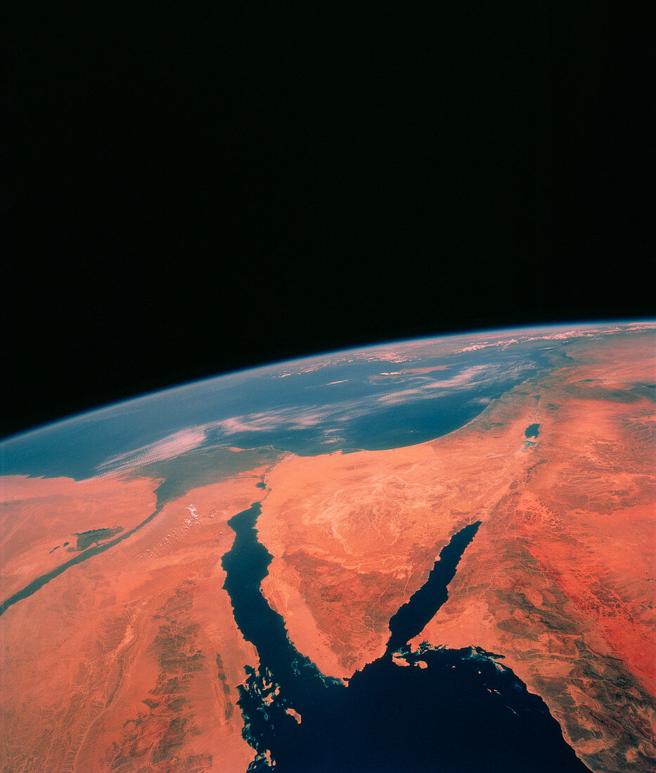
| Shuttle photograph of the Sinai Peninsula (centre) showing parts of Egypt,Israel,Jordan and Saudi Arabia. The Mediterranean is visible at top,under a haze believed to be due to wind-borne dust,and the very northern part of the Red Sea can be seen at bottom. The latter appears unusually clear of river sediment because of the prevailing dry climate at the time the photo was taken. The Sinai Peninsula is flanked on the left by the Gulf of Suez and on the right by the Gulf of Aqaba. The great rift of the Gulf of Aqaba is clearly visible extending northwards through the Dead Sea towards Turkey (top right). The photo was taken from the space shuttle Columbia during mission STS-40 | |
| Licence : | Droits gérés |
| Crédit: | Science Photo Library / NASA |
| Taille de l’image : | 3415 px × 4025 px |
| Model Release : | Non requis |
| Property Release : | Non requis |
| Restrictions : | - |
Prix pour cette image À partir de 45 €
Produit vendu
(Calendrier, Carte postale, Carte de vœux, Impression sur textile, Packaging etc)
À partir de 45 €
Usage commercial
(Affichage, Annonce presse, Annonce TV, Carte, Digital - hors rés. sociaux, Digital - rés. sociaux etc)
À partir de 45 €
Éditorial
(Digital, Journal, Livre, Livre pratique, Magazine, Télévision etc)
À partir de 60 €
Usage non-commercial
(Digital - hors rés. sociaux, Digital - rés. sociaux etc)
À partir de 120 €