Northerly vegetation map
Numéro d’image : 11735583
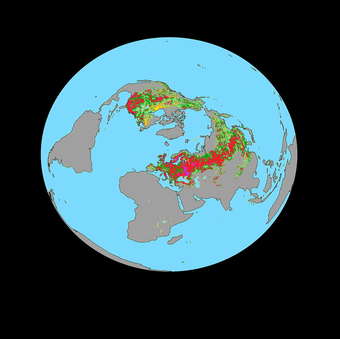
| Vegetation map. Computer-generated map showing increased plant growth above a latitude of 40 degrees north,between 1981 and 1999. Plant density is colour-coded,increasing from yellow (low),through green and red,to purple (high). The map,based on satellite data,indicates that vegetation in regions of the Northern hemisphere has increased in density,with Eurasia 'greening' more rapidly than North America. These increases strongly correlate with local temperature data,indicating a link with global warming. Increased vegetation may act to counter-act global warming,however,by absorbing more carbon dioxide (a greenhouse gas) | |
| Licence : | Droits gérés |
| Crédit: | Science Photo Library / NASA |
| Taille de l’image : | 2094 px × 2089 px |
| Model Release : | Non requis |
| Property Release : | Non requis |
| Restrictions : | - |
Prix pour cette image À partir de 45 €
Produit vendu
(Calendrier, Carte postale, Carte de vœux, Impression sur textile, Packaging etc)
À partir de 45 €
Usage commercial
(Affichage, Annonce presse, Annonce TV, Carte, Digital - hors rés. sociaux, Digital - rés. sociaux etc)
À partir de 45 €
Éditorial
(Digital, Journal, Livre, Livre pratique, Magazine, Télévision etc)
À partir de 60 €
Usage non-commercial
(Digital - hors rés. sociaux, Digital - rés. sociaux etc)
À partir de 120 €
Mots clés
- accru,
- Amérique du Nord,
- augmenté,
- augmenter,
- carte,
- continent,
- continents,
- croissance de plante,
- croissance végétale,
- données globales,
- environnement,
- environnemental,
- Eurasie,
- globe,
- illustration,
- latitudes,
- mer,
- mers,
- océan,
- océans,
- oeuvre,
- planète,
- Pôle Nord,
- réchauffement climatique,
- science de la terre,
- sciences,
- statistiques,
- température,
- terre,
- végétation