European population map
Numéro d’image : 11723061
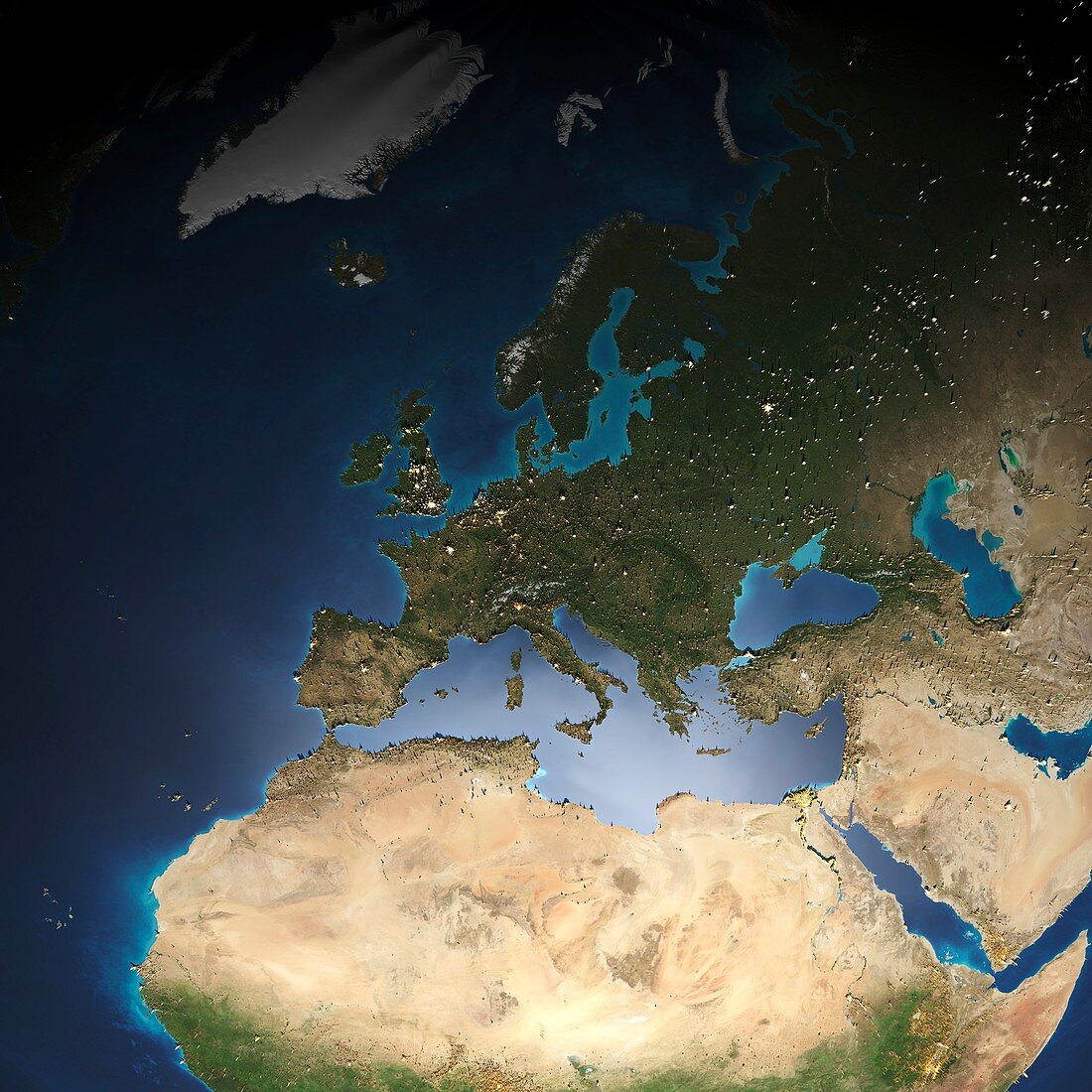
| European population map. Demographic map of population data in Europe and surrounding areas,with the peaks (yellow) showing areas of high population density. The data is based on light pollution and ambient population (data averaged over a 24-hour period) | |
| Licence : | Droits gérés |
| Crédit: | Science Photo Library / Pharand-Deschenes, Felix |
| Taille de l’image : | 4185 px × 4185 px |
| Model Release : | Non requis |
| Property Release : | Non requis |
| Restrictions : | - |
Prix pour cette image À partir de 45 €
Produit vendu
(Calendrier, Carte postale, Carte de vœux, Impression sur textile, Packaging etc)
À partir de 45 €
Usage commercial
(Affichage, Annonce presse, Annonce TV, Carte, Digital - hors rés. sociaux, Digital - rés. sociaux etc)
À partir de 45 €
Éditorial
(Digital, Journal, Livre, Livre pratique, Magazine, Télévision etc)
À partir de 60 €
Usage non-commercial
(Digital - hors rés. sociaux, Digital - rés. sociaux etc)
À partir de 120 €
Mots clés
- 21ème siècle,
- ANTHOPOGENIC,
- anthroposphere,
- aucun,
- carte,
- data,
- démographie,
- démographique,
- donnée,
- effets,
- ensemble de données,
- Europe,
- européen,
- géographie,
- géographie humaine,
- géographique,
- illustration,
- impact humain,
- oeuvre,
- personne,
- pollution légère,
- présence humaine,
- sciences de l'environnement,
- Sciences de la Terre,
- sciences environnementales,
- terre,
- villes,
- XX1ème siècle