The American Atlas
Numéro d’image : 11674315
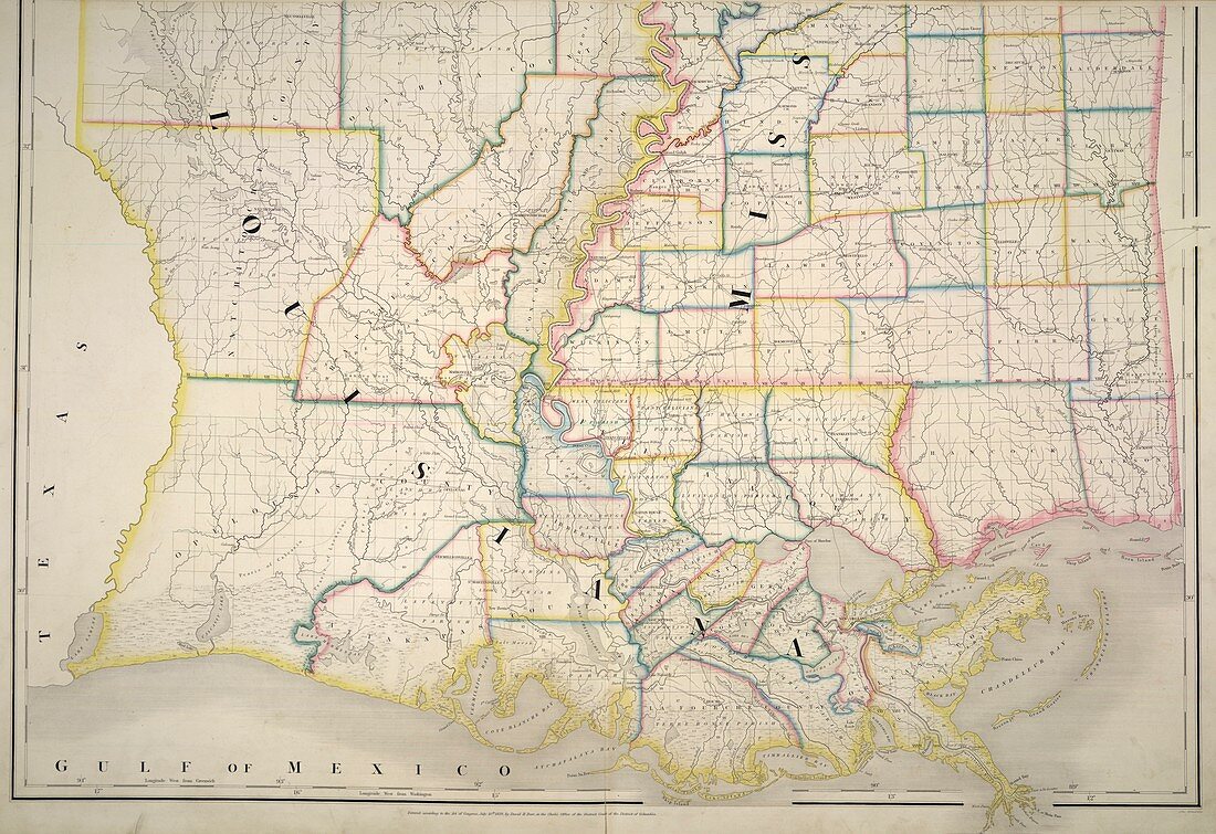
| Louisiana and Mississippi,Map of Louisiana and Mississippi. Image taken from The American Atlas; exhibiting the Post Offices,Post Roads,Rail Roads,Canals,and the Physical and Political Divisions of the United States of North America; Constructed from the Government Surveys and other Official Materials. By D.H. Burr. John Arrowsmith del. Originally published in Washington,D.C. : D.H. Burr,July 10th,1839. Author D H Burr,Illustrated by John Arrowsmith | |
| Licence : | Droits gérés |
| Crédit: | Science Photo Library / British Library |
| Taille de l’image : | 4960 px × 3405 px |
| Model Release : | Non requis |
| Property Release : | Non requis |
| Restrictions : | - |
Prix pour cette image À partir de 45 €
Produit vendu
(Calendrier, Carte postale, Carte de vœux, Impression sur textile, Packaging etc)
À partir de 45 €
Usage commercial
(Affichage, Annonce presse, Annonce TV, Carte, Digital - hors rés. sociaux, Digital - rés. sociaux etc)
À partir de 45 €
Éditorial
(Digital, Journal, Livre, Livre pratique, Magazine, Télévision etc)
À partir de 60 €
Usage non-commercial
(Digital - hors rés. sociaux, Digital - rés. sociaux etc)
À partir de 120 €