Tothill Fields,Westminster
Numéro d’image : 11674224
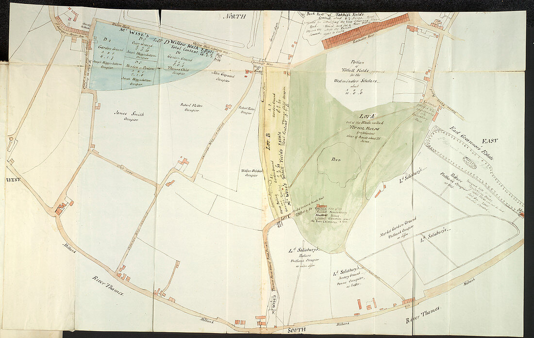
| Tothill Fields,Westminster,Whole plan Plan of Tothill Fields,Westminster; between Millbank and Westminster Abbey. The plan shows Rochester Row,Horseferry Road,and the site of the almshouses 'the Five Chimneys',built as pest-houses for victims of the plague Image taken from Pelham Papers. Originally published in England; circa 1796-1803 | |
| Licence : | Droits gérés |
| Crédit: | Science Photo Library / British Library |
| Taille de l’image : | 5255 px × 3326 px |
| Model Release : | Non requis |
| Property Release : | Non requis |
| Restrictions : | - |
Prix pour cette image À partir de 45 €
Produit vendu
(Calendrier, Carte postale, Carte de vœux, Impression sur textile, Packaging etc)
À partir de 45 €
Usage commercial
(Affichage, Annonce presse, Annonce TV, Carte, Digital - hors rés. sociaux, Digital - rés. sociaux etc)
À partir de 45 €
Éditorial
(Digital, Journal, Livre, Livre pratique, Magazine, Télévision etc)
À partir de 60 €
Usage non-commercial
(Digital - hors rés. sociaux, Digital - rés. sociaux etc)
À partir de 120 €