Cloud streets over US east coast
Numéro d’image : 11673027
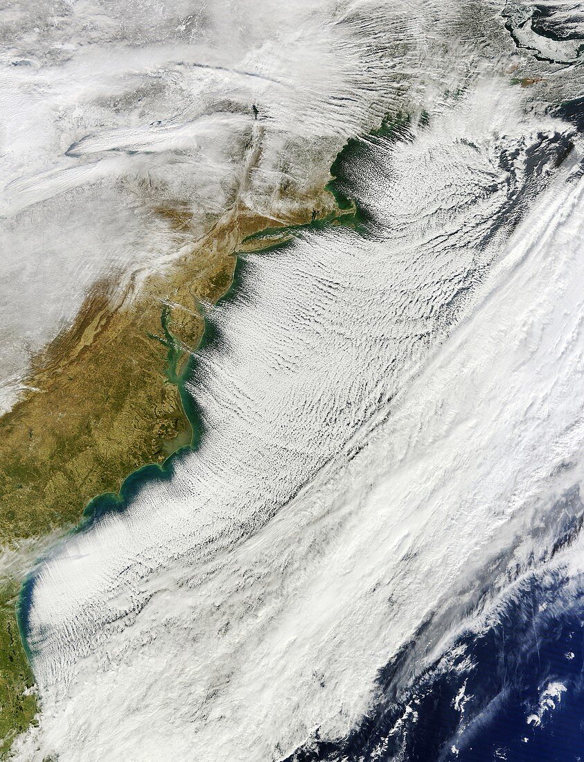
| Cloud streets over the US east coast on the 7th January 2014,satellite image. Cloud streets are parallel lines of clouds aligned with the wind. These are cumulus clouds,which result from rising columns of warmed air (thermals),in this case from the Atlantic Ocean. Behind them are the clear skies and bitterly cold air of a polar vortex and a blanket of snow on the ground. Polar vortices are areas of low pressure found over each pole. This vortex was pushed south by a high pressure system stuck over Canada and Greenland. It caused record low temperatures that were colder than those at the North Pole. Image obtained by the MODIS (moderate resolution imaging spectroradiometer) instrument on NASA's Terra satellite | |
| Licence : | Droits gérés |
| Crédit: | Science Photo Library / NASA |
| Taille de l’image : | 3684 px × 4809 px |
| Model Release : | Non requis |
| Property Release : | Non requis |
| Restrictions : | - |
Prix pour cette image À partir de 45 €
Produit vendu
(Calendrier, Carte postale, Carte de vœux, Impression sur textile, Packaging etc)
À partir de 45 €
Usage commercial
(Affichage, Annonce presse, Annonce TV, Carte, Digital - hors rés. sociaux, Digital - rés. sociaux etc)
À partir de 45 €
Éditorial
(Digital, Journal, Livre, Livre pratique, Magazine, Télévision etc)
À partir de 60 €
Usage non-commercial
(Digital - hors rés. sociaux, Digital - rés. sociaux etc)
À partir de 120 €
Mots clés
- 2014,
- 21ème siècle,
- aligné,
- alignement,
- américain,
- Amérique du Nord,
- Arctique,
- avant,
- basse pression,
- côte,
- Côte Est,
- côtier,
- de l'espace,
- devant,
- Etats-Unis,
- extrême,
- front froid,
- hiver,
- image satellite,
- le plus froid,
- météo,
- météorologie,
- météorologique,
- modis,
- neige,
- nuages,
- Océan Atlantique,
- parallèle,
- satellite,
- spectroradiomètre imageur à résolution moyenne,
- terra,
- terre,
- USA,
- vague de froid,
- vortex polaire,
- XX1ème siècle