North Africa and Europe,satellite image
Numéro d’image : 11649054
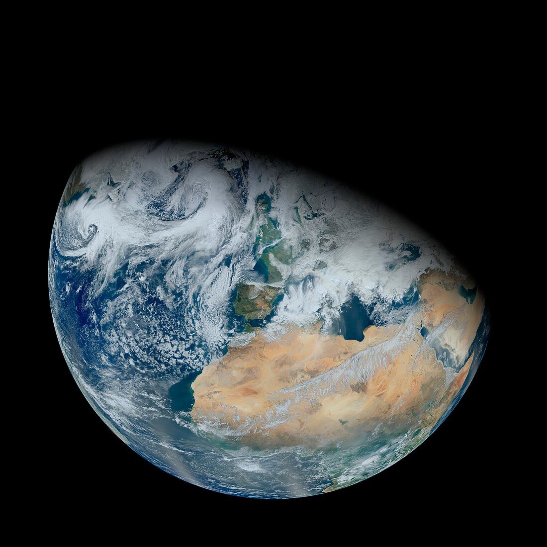
| North Africa and Europe,satellite image. North is towards top. Clouds (white) are seen over most of Europe,with a cloud-free view over the vast expanse of the Sahara (brown) in North Africa. Image data obtained on 3 February 2012 by the Visible Infrared Imaging Radiometer Suite (VIIRS) instrument,soon after its launch on the Suomi NPP (Suomi National Polar-orbiting Partnership) satellite | |
| Licence : | Droits gérés |
| Crédit: | Science Photo Library / Kuring, Norman / NASA / GSFC |
| Taille de l’image : | 4205 px × 4205 px |
| Model Release : | Non requis |
| Property Release : | Non requis |
| Restrictions : | - |
Prix pour cette image À partir de 45 €
Produit vendu
(Calendrier, Carte postale, Carte de vœux, Impression sur textile, Packaging etc)
À partir de 45 €
Usage commercial
(Affichage, Annonce presse, Annonce TV, Carte, Digital - hors rés. sociaux, Digital - rés. sociaux etc)
À partir de 45 €
Éditorial
(Digital, Journal, Livre, Livre pratique, Magazine, Télévision etc)
À partir de 60 €
Usage non-commercial
(Digital - hors rés. sociaux, Digital - rés. sociaux etc)
À partir de 120 €
Mots clés
- 2012,
- 21ème siècle,
- Afrique du Nord,
- courbe,
- courber,
- courbure,
- de l'espace,
- désert,
- eau,
- Europe,
- européen,
- géographie,
- géographique,
- gibbeux,
- image satellite,
- instrument VIIRS,
- lumière du soleil,
- membre,
- mer,
- nuage,
- nuages,
- nuageux,
- obscurité,
- observation de la terre,
- planétaire,
- planète,
- Sahara,
- saharien,
- satellite,
- Suomi NPP,
- terre,
- VIIRS,
- Visible Infrared Imaging Radiometer Suite,
- XX1ème siècle