Typhoon Bopha,satellite image
Numéro d’image : 11639823
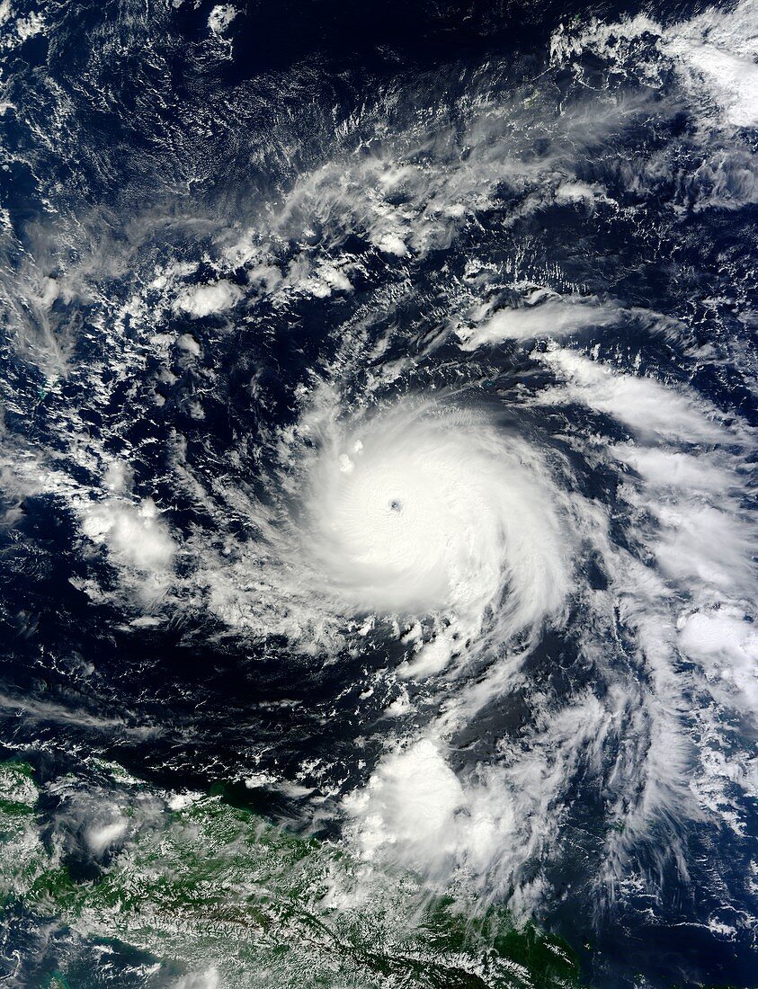
| Typhoon Bopha. Satellite image of typhoon Bopha in the Pacific Ocean on 1st December 2012. Bopha made landfall on the 4th December bring high winds and heavy rain that caused landfalls and flooding. Over 400 people were killed and over 300,000 were made homeless. Typhoons are huge cyclonic storm systems of high winds blowing around a central eye. They form in areas of relatively calm ocean around the equator. As moist air is forced upwards,a low pressure region forms that becomes the eye of the storm. Image obtained by the Moderate Resolution Imaging Spectroradiometer (MODIS) sensor on NASA's Terra satellite | |
| Licence : | Droits gérés |
| Crédit: | Science Photo Library / JEFF SCHMALTZ MODIS LAND RAPID RESPONSE TEAM, NASA GSFC |
| Taille de l’image : | 4025 px × 5255 px |
| Model Release : | Non requis |
| Property Release : | Non requis |
| Restrictions : | - |
Prix pour cette image À partir de 45 €
Produit vendu
(Calendrier, Carte postale, Carte de vœux, Impression sur textile, Packaging etc)
À partir de 45 €
Usage commercial
(Affichage, Annonce presse, Annonce TV, Carte, Digital - hors rés. sociaux, Digital - rés. sociaux etc)
À partir de 45 €
Éditorial
(Digital, Journal, Livre, Livre pratique, Magazine, Télévision etc)
À partir de 60 €
Usage non-commercial
(Digital - hors rés. sociaux, Digital - rés. sociaux etc)
À partir de 120 €
Mots clés
- 21ème siècle,
- asiatique,
- Asie,
- catastrophe naturelle,
- catégorie 5,
- catégorie cinq,
- de l'espace,
- en spirale,
- image satellite,
- météo,
- météorologie,
- météorologique,
- modis,
- observation de la terre,
- Océan Pacifique,
- oeil,
- ouragan,
- Philippines,
- satellite,
- spectroradiomètre imageur à résolution moyenne,
- spirale,
- super typhon,
- tempête,
- terra,
- terre,
- typhon,
- XX1ème siècle