Minot flooding,USA,satellite image
Numéro d’image : 11635261
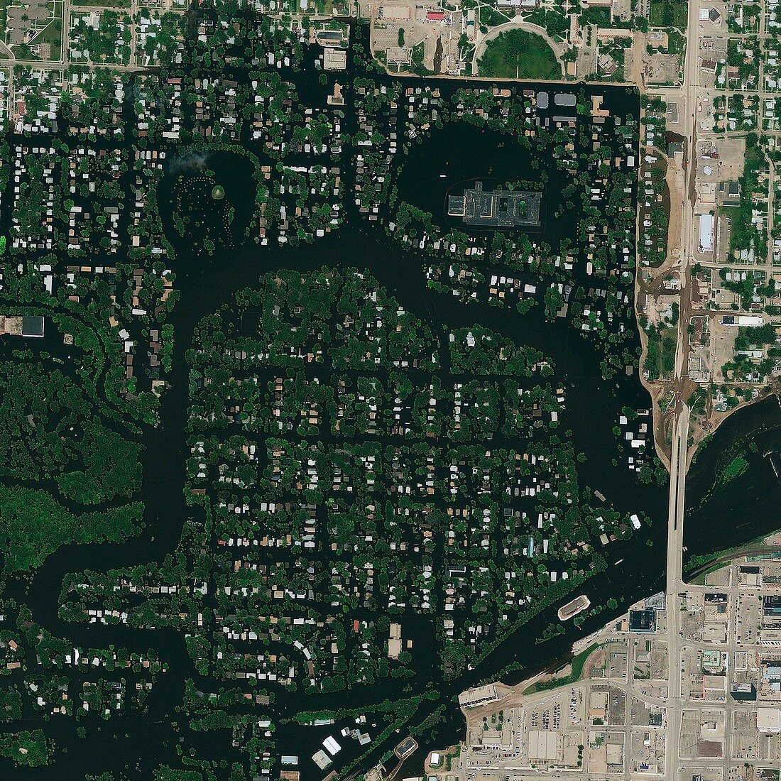
| Minot. Satellite image showing the Souris River (black),which has burst its banks and flooded the surrounding neighbourhoods of Minot,North Dakota,USA. Imaged by the GeoEye-1 satellite,on 25th June 2011 | |
| Licence : | Droits gérés |
| Crédit: | Science Photo Library / Geoeye |
| Taille de l’image : | 3000 px × 3000 px |
| Model Release : | Non requis |
| Restrictions : | - |
Prix pour cette image À partir de 45 €
Produit vendu
(Calendrier, Carte postale, Carte de vœux, Impression sur textile, Packaging etc)
À partir de 45 €
Usage commercial
(Affichage, Annonce presse, Annonce TV, Carte, Digital - hors rés. sociaux, Digital - rés. sociaux etc)
À partir de 45 €
Éditorial
(Digital, Journal, Livre, Livre pratique, Magazine, Télévision etc)
À partir de 60 €
Usage non-commercial
(Digital - hors rés. sociaux, Digital - rés. sociaux etc)
À partir de 120 €
Mots clés
- 2011,
- 21ème siècle,
- 25ème,
- américain,
- Amérique du Nord,
- bâtiment,
- bâtiments,
- catastrophe naturelle,
- Dakota du nord,
- de l'espace,
- eau,
- environnement,
- Etats-Unis,
- geoeye-1,
- géographie,
- géographique,
- image satellite,
- immeubles,
- inondation,
- inondé,
- N/A,
- observation de la terre,
- satellite,
- sciences de l'environnement,
- sciences environnementales,
- urbain,
- US,
- USA,
- ville,
- XX1ème siècle