Lake Meredith,USA,1990-2011
Numéro d’image : 11631926
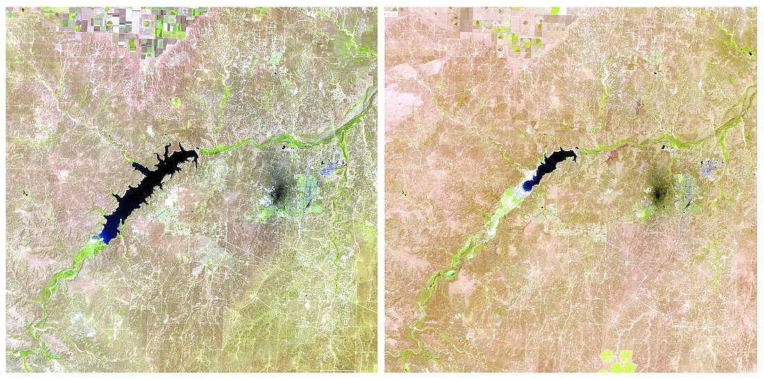
| Lake Meredith,USA,1990-2011. Landsat satellite photograph showing Lake Meredith in 1990 and 2011. This is an artificial lake formed by the Sanford Dam in Texas. The image on the right taken in 2011 clearly shows how much water loss through continual drought has occured since 1990 (left) | |
| Licence : | Droits gérés |
| Crédit: | Science Photo Library / NASA |
| Taille de l’image : | 4223 px × 2105 px |
| Model Release : | Non requis |
| Property Release : | Non requis |
| Restrictions : | - |
Prix pour cette image À partir de 45 €
Produit vendu
(Calendrier, Carte postale, Carte de vœux, Impression sur textile, Packaging etc)
À partir de 45 €
Usage commercial
(Affichage, Annonce presse, Annonce TV, Carte, Digital - hors rés. sociaux, Digital - rés. sociaux etc)
À partir de 45 €
Éditorial
(Digital, Journal, Livre, Livre pratique, Magazine, Télévision etc)
À partir de 60 €
Usage non-commercial
(Digital - hors rés. sociaux, Digital - rés. sociaux etc)
À partir de 120 €