North Atlantic region,1630
Numéro d’image : 11622217
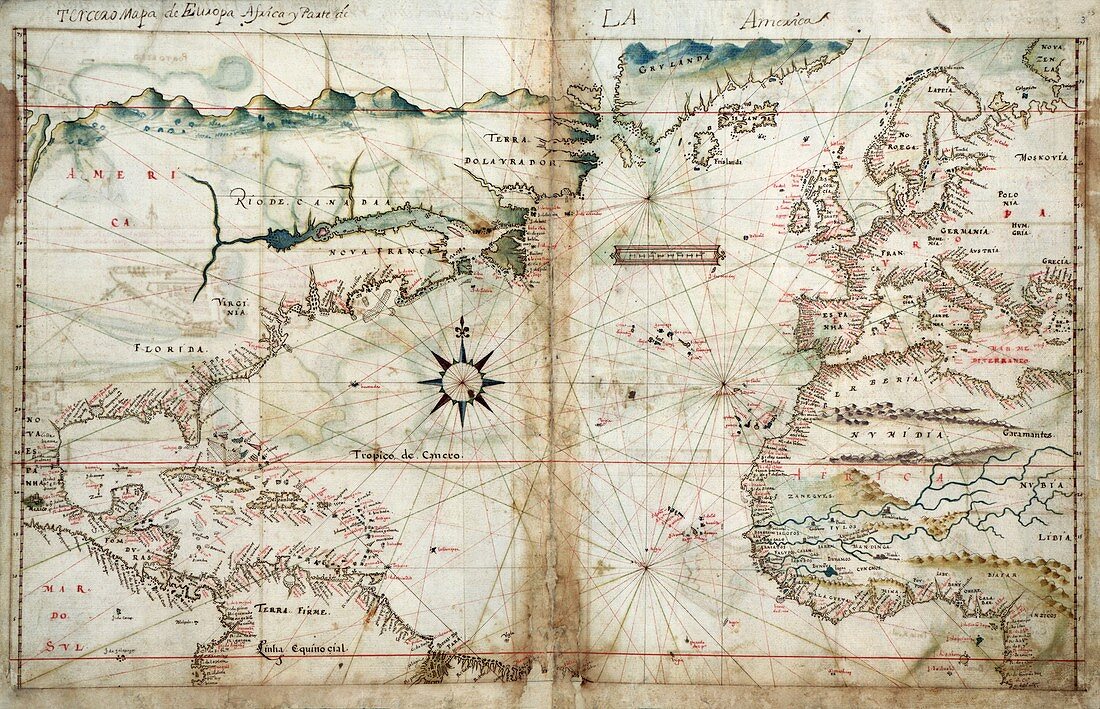
| North Atlantic region. 1630 map of the lands associated with the North Atlantic Ocean,from an atlas ('Taboas geraes de toda a navegacao') by 17th-century Portuguese cartographer Joao Teixeira Albernaz. This map includes details of the coasts of Europe,northern and western Africa,northern South America,and eastern North America. Also shown are a compass rose,a scale bar,rhumb lines,and mountains and rivers. Features include the 'Rio de Canada' (Gulf of St Lawrence) in Canada,two large rivers in Africa (Senegal River and Gambia River),Greenland (top),the Caribbean (lower left) and the Canary and Cape Verde islands | |
| Licence : | Droits gérés |
| Crédit: | Science Photo Library / Library of Congress |
| Taille de l’image : | 5212 px × 3361 px |
| Model Release : | Non requis |
| Property Release : | Non requis |
| Restrictions : | - |
Prix pour cette image À partir de 45 €
Produit vendu
(Calendrier, Carte postale, Carte de vœux, Impression sur textile, Packaging etc)
À partir de 45 €
Usage commercial
(Affichage, Annonce presse, Annonce TV, Carte, Digital - hors rés. sociaux, Digital - rés. sociaux etc)
À partir de 45 €
Éditorial
(Digital, Journal, Livre, Livre pratique, Magazine, Télévision etc)
À partir de 60 €
Usage non-commercial
(Digital - hors rés. sociaux, Digital - rés. sociaux etc)
À partir de 120 €
Mots clés
- 1600,
- 1630,
- 17ème siècle,
- Afrique,
- âge de la découverte,
- Amérique du Nord,
- Amérique du Sud,
- Atlantique Nord,
- Bahamas,
- caraïbes,
- carte,
- cartographie,
- cartographique,
- continent,
- continental,
- continents,
- Cuba,
- Europe,
- européen,
- Floride,
- géographie,
- géographique,
- Groenland,
- histoire,
- historique,
- île de Cap Vert,
- Iles Canaries,
- illustration,
- océan,
- oeuvre,
- portugais,
- région,
- XVIIème siècle