Tornado track,satellite image
Numéro d’image : 11614305
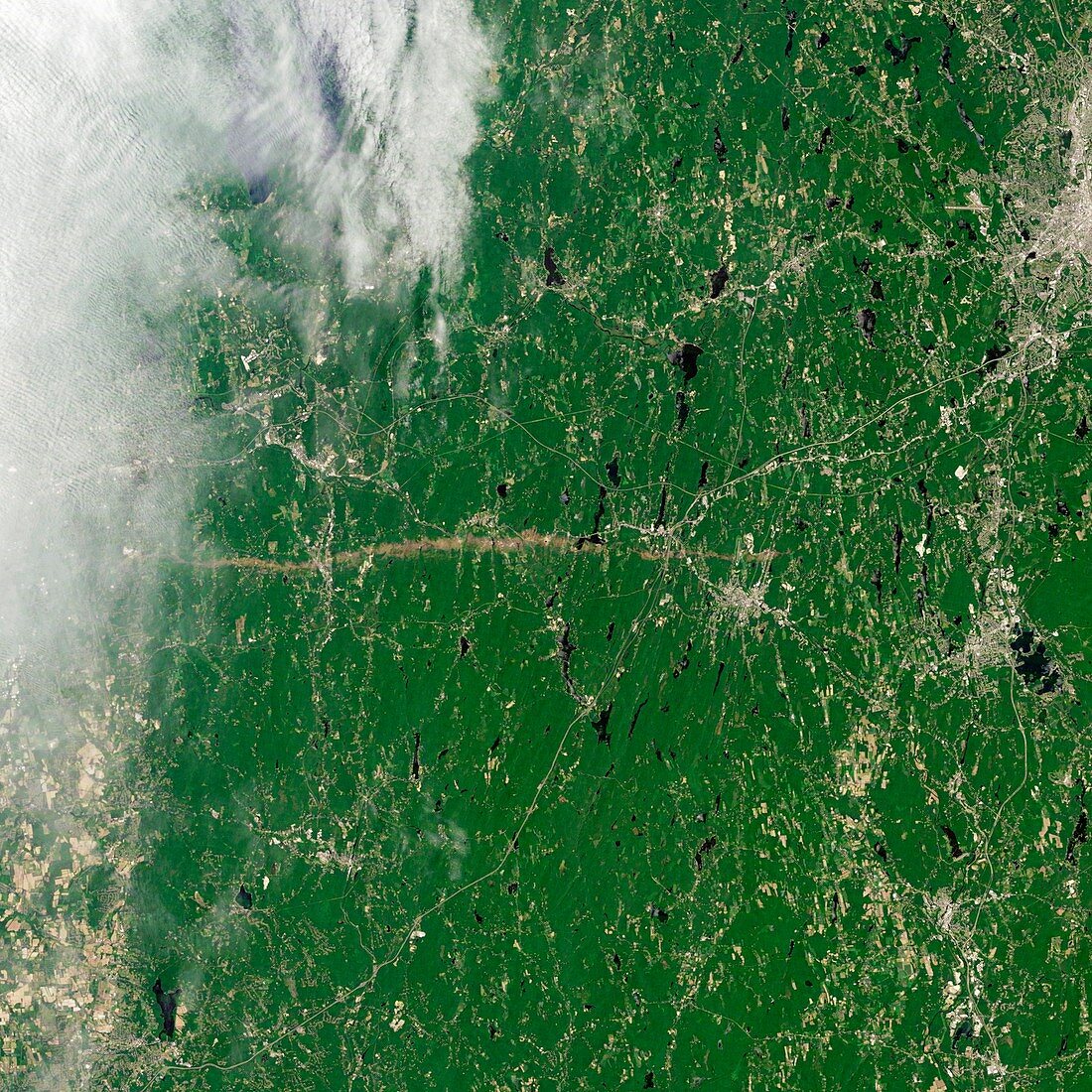
| Tornado track,satellite image. Landsat 5 satellite image showing a tornado track (running middle far left to centre right). On the 1st June 2011,a supercell thunderstorm developed over western Massachusetts. The storm produced an EF3 tornado (severe on the Enhanced Fujita Scale) that cut a 39-mile (63-kilometer) track of destruction across southwest and south-central Massachusetts. The towns of Sturbridge and Soutbridge are right of centre middle and Worcester is upper right. Further east lies the major city of Boston | |
| Licence : | Droits gérés |
| Crédit: | Science Photo Library / NASA |
| Taille de l’image : | 2976 px × 2976 px |
| Model Release : | Non requis |
| Property Release : | Non requis |
| Restrictions : | - |
Prix pour cette image À partir de 45 €
Produit vendu
(Calendrier, Carte postale, Carte de vœux, Impression sur textile, Packaging etc)
À partir de 45 €
Usage commercial
(Affichage, Annonce presse, Annonce TV, Carte, Digital - hors rés. sociaux, Digital - rés. sociaux etc)
À partir de 45 €
Éditorial
(Digital, Journal, Livre, Livre pratique, Magazine, Télévision etc)
À partir de 60 €
Usage non-commercial
(Digital - hors rés. sociaux, Digital - rés. sociaux etc)
À partir de 120 €