Aral Sea,satellite image,2010
Numéro d’image : 11604688
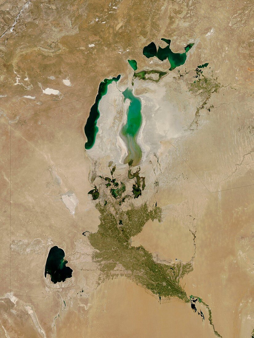
| Aral Sea,satellite image. North is at top. This inland lake is found between Uzbekistan (west) and Kazakhstan (east) and used to be the fourth largest lake in the world. Since the 1960s it has lost more than half of its volume. This is due to overuse of the feeder rivers (the Syr Darya and Amu Darya) in irrigation of cotton and paddy fields,and a severe drought that lasted from 2006 to 2009. In 2010 the drought broke and some water has returned to the Aral Sea. Image obtained on the 26th August 2010 using the MODIS instrument on NASA's Terra satellite. For an image of the area in 2009 see C003/2112 | |
| Licence : | Droits gérés |
| Crédit: | Science Photo Library / NASA |
| Taille de l’image : | 2657 px × 3543 px |
| Model Release : | Non requis |
| Property Release : | Non requis |
| Restrictions : | - |
Prix pour cette image À partir de 45 €
Produit vendu
(Calendrier, Carte postale, Carte de vœux, Impression sur textile, Packaging etc)
À partir de 45 €
Usage commercial
(Affichage, Annonce presse, Annonce TV, Carte, Digital - hors rés. sociaux, Digital - rés. sociaux etc)
À partir de 45 €
Éditorial
(Digital, Journal, Livre, Livre pratique, Magazine, Télévision etc)
À partir de 60 €
Usage non-commercial
(Digital - hors rés. sociaux, Digital - rés. sociaux etc)
À partir de 120 €
Mots clés
- 21ème siècle,
- aride,
- aridité,
- asiatique,
- Asie,
- damné,
- de l'espace,
- désert,
- endigué,
- évaporation,
- fait un barrage,
- géographie,
- géographique,
- image satellite,
- impact humain,
- Kazakhstan,
- lac,
- lits de sel,
- mer,
- Mer d'Aral,
- modis,
- observation de la terre,
- Ouzbékistan,
- réduction,
- réduit,
- remise,
- rétrèci,
- rétrécir,
- rétrécissement,
- sécher,
- sel,
- terra,
- terre,
- XX1ème siècle