Rainfall levels,November 2004
Numéro d’image : 11599572
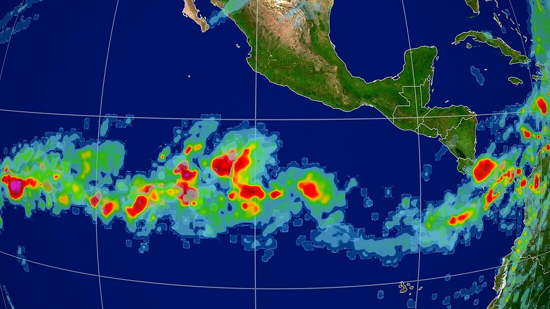
| Rainfall levels. Satellite image showing precipitation levels over the Central America on 8th November 2004. Amount of precipitation,measured in millimetres,is colour-coded from green (lowest) through yellow,orange and red to purple (highest). Rain across the middle of the Pacific Ocean,as seen here,is typical of an El nino year. El Nino is a warming of surface waters in the tropical eastern Pacific Ocean. It may persist for a year or more,and causes drier conditions in Australia and South-East Asia,and wetter and warmer conditions in the Americas,with often dire effects for agriculture. Data from NASA's Global Precipitation Measurement (GPM) mission | |
| Licence : | Droits gérés |
| Crédit: | Science Photo Library / NASA's Goddard Space Flight Center / SVS |
| Taille de l’image : | 3969 px × 2232 px |
| Model Release : | Non requis |
| Property Release : | Non requis |
| Restrictions : | - |
Prix pour cette image À partir de 45 €
Produit vendu
(Calendrier, Carte postale, Carte de vœux, Impression sur textile, Packaging etc)
À partir de 45 €
Usage commercial
(Affichage, Annonce presse, Annonce TV, Carte, Digital - hors rés. sociaux, Digital - rés. sociaux etc)
À partir de 45 €
Éditorial
(Digital, Journal, Livre, Livre pratique, Magazine, Télévision etc)
À partir de 60 €
Usage non-commercial
(Digital - hors rés. sociaux, Digital - rés. sociaux etc)
À partir de 120 €
Mots clés
- 21ème siècle,
- Amérique Centrale,
- averse,
- chute de pluie,
- continent,
- cycle de l'eau,
- EL NINO,
- géographie,
- géographique,
- globe,
- hydrologie,
- image satellite,
- météo,
- météorologie,
- météorologique,
- observation de la terre,
- océan,
- Océan Atlantique,
- Océan Pacifique,
- planète,
- pluie,
- précipitation,
- satellite,
- terre,
- XX1ème siècle