18th Century Chinese wood block print
Numéro d’image : 11591798
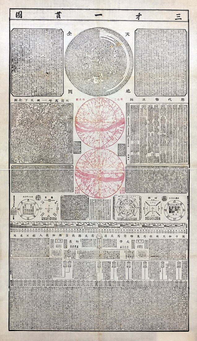
| 18th Century Chinese wood block print. This print includes maps of China and the World,astronomical maps of the polar regions (lower two circles,centre),a chronological table of Chinese history showing the dates of the dynasties,maps of the planets and their orbits,excerpts of Chinese classic literature and other writings,and a perpetual map of the unified Qing empire (centre left). Created by A.S. Lu,in Shaoxing,China,in 1722 | |
| Licence : | Droits gérés |
| Crédit: | Science Photo Library / Library of Congress |
| Taille de l’image : | 4023 px × 6957 px |
| Model Release : | Non requis |
| Property Release : | Non requis |
| Restrictions : | - |
Prix pour cette image À partir de 45 €
Produit vendu
(Calendrier, Carte postale, Carte de vœux, Impression sur textile, Packaging etc)
À partir de 45 €
Usage commercial
(Affichage, Annonce presse, Annonce TV, Carte, Digital - hors rés. sociaux, Digital - rés. sociaux etc)
À partir de 45 €
Éditorial
(Digital, Journal, Livre, Livre pratique, Magazine, Télévision etc)
À partir de 60 €
Usage non-commercial
(Digital - hors rés. sociaux, Digital - rés. sociaux etc)
À partir de 120 €
Mots clés
- 1700,
- 18ème siècle,
- A.S. LU,
- astrologie,
- astrologique,
- astronomie,
- astronomique,
- carte,
- cartes,
- Chine,
- chinois,
- chronologie,
- chronologique,
- dynastie,
- écrire,
- écriture,
- écritures,
- géographie,
- géographique,
- histoire,
- historique,
- illustration,
- monde,
- oeuvre,
- orbite,
- orbites,
- planète,
- planètes,
- pôle,
- pôles,
- poteau,
- région polaire,
- régions,
- soulagement,
- table,
- XVIIIème siècle