Landslide,Pakistan,satellite image
Numéro d’image : 11591132
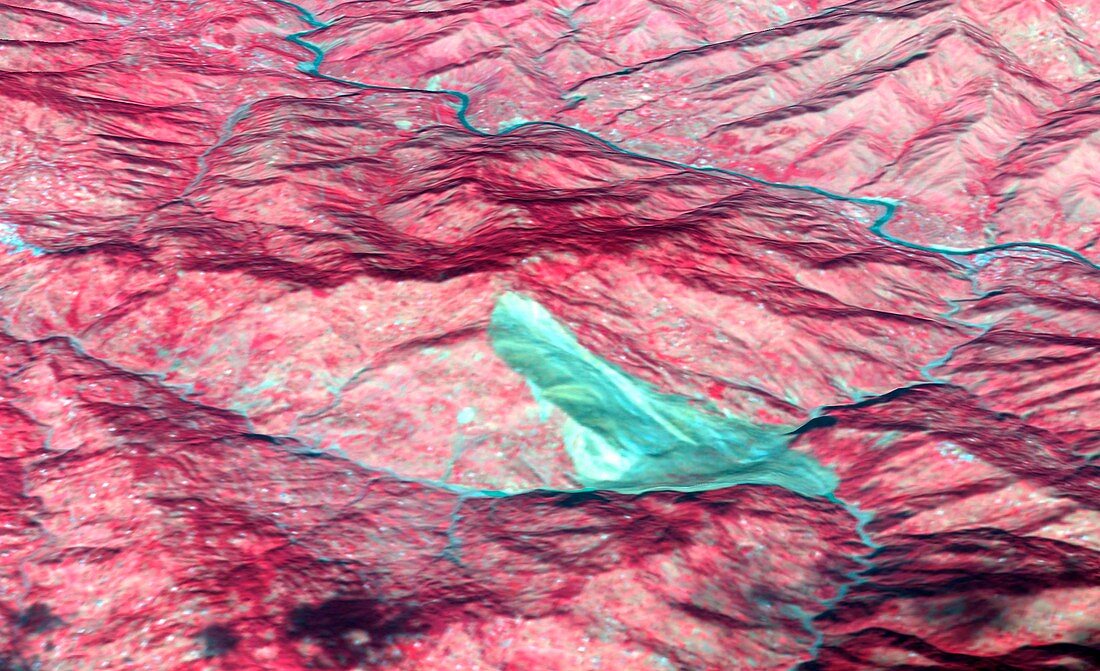
| Landslide. Satellite image of a landslide (light blue) in the Pir Punjal mountain range in northern Pakistan. This landslide was triggered by an earthquake in the area on 8th October 2005. This image combines Shuttle Radar Topography Mission data with an image from the Advanced Spaceborne Thermal Emission and Reflection Radiometer (ASTER) on NASA's Terra spacecraft and was taken on 11th October 2005 | |
| Licence : | Droits gérés |
| Crédit: | Science Photo Library / NASA / JAPAN ASTER SCIENCE TEAM / ERSDAC / METI / GSFC |
| Taille de l’image : | 3300 px × 2014 px |
| Model Release : | Non requis |
| Property Release : | Non requis |
| Restrictions : | - |
Prix pour cette image À partir de 45 €
Produit vendu
(Calendrier, Carte postale, Carte de vœux, Impression sur textile, Packaging etc)
À partir de 45 €
Usage commercial
(Affichage, Annonce presse, Annonce TV, Carte, Digital - hors rés. sociaux, Digital - rés. sociaux etc)
À partir de 45 €
Éditorial
(Digital, Journal, Livre, Livre pratique, Magazine, Télévision etc)
À partir de 60 €
Usage non-commercial
(Digital - hors rés. sociaux, Digital - rés. sociaux etc)
À partir de 120 €
Mots clés
- 20ème siècle,
- asiatique,
- Asie,
- aster,
- Cachemire,
- chaîne de montagnes,
- chaîne montagneuse,
- cordillère,
- de l'espace,
- éboulement,
- géographie,
- géographique,
- géologie,
- géologique,
- glissement de terrain,
- image satellite,
- montagne,
- Pakistan,
- pakistanais,
- radiomètre spatial à émission thermique et à reflexion de pointe,
- rivière,
- rivières,
- satellite,
- terra,
- terre,
- topographique,
- tremblement de terre,
- XXème siècle