Hawaii,satellite image
Numéro d’image : 11570982
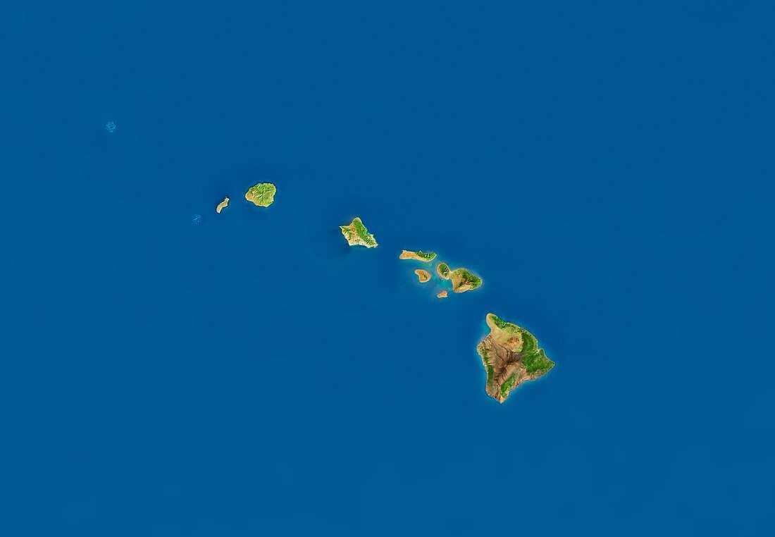
| Hawaii,satellite image. North is at top. This mosaic of cloud-free satellite images shows the Hawaiian islands (from left) Lehua,Kauai,Oahu,Molokai,Maui and Hawaii (or Big Island). The data used in this image has been obtained by the MODIS instrument on NASA's Terra satellite | |
| Licence : | Droits gérés |
| Crédit: | Science Photo Library / Planetary Visions |
| Taille de l’image : | 5200 px × 3600 px |
| Model Release : | Non requis |
| Property Release : | Non requis |
| Restrictions : | - |
Prix pour cette image À partir de 45 €
Produit vendu
(Calendrier, Carte postale, Carte de vœux, Impression sur textile, Packaging etc)
À partir de 45 €
Usage commercial
(Affichage, Annonce presse, Annonce TV, Carte, Digital - hors rés. sociaux, Digital - rés. sociaux etc)
À partir de 45 €
Éditorial
(Digital, Journal, Livre, Livre pratique, Magazine, Télévision etc)
À partir de 60 €
Usage non-commercial
(Digital - hors rés. sociaux, Digital - rés. sociaux etc)
À partir de 120 €
Mots clés
- américain,
- côte,
- côtes,
- côtier,
- couleur naturelle,
- de l'espace,
- eau,
- état,
- Etats-Unis,
- géographie,
- géographique,
- hawaïen,
- Hawaii,
- île,
- îles,
- image satellite,
- littoral,
- littoraux,
- mer,
- modis,
- montagne,
- montagnes,
- nature,
- observation de la terre,
- Océan Pacifique,
- région,
- sans nuage,
- sans nuages,
- satellite,
- spectroradiomètre imageur à résolution moyenne,
- terra,
- terre,
- USA,
- végétation,
- volcan,
- volcanique,
- volcans