Reunion volcanoes,satellite image
Numéro d’image : 11564726
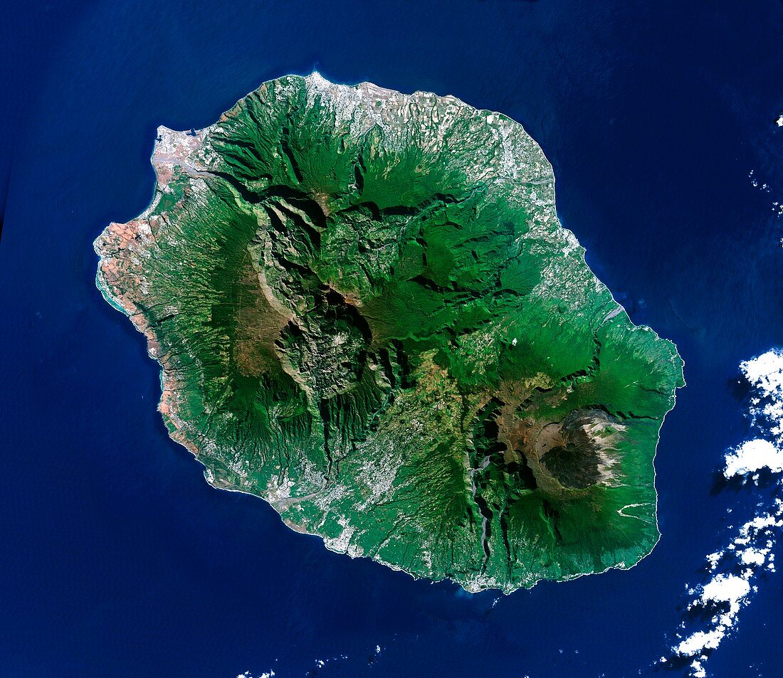
| Reunion volcanoes,satellite image. Satellite image showing the volcanoes on Reunion Island in the Indian Ocean. North is at top. Green is vegetation,blue is water,and clouds are white. Piton des Neiges volcano (upper left) is the highest point on the island at 3069 metres. Piton de la Fournaise (2632 metres,lower right) is an active shield volcano on the eastern end of the island. The island is 63 by 45 kilometres. Image data obtained on 19 June 2000 | |
| Licence : | Droits gérés |
| Crédit: | Science Photo Library / Planetobserver |
| Taille de l’image : | 4497 px × 3898 px |
| Model Release : | Non requis |
| Property Release : | Non requis |
| Restrictions : | - |
Prix pour cette image À partir de 45 €
Produit vendu
(Calendrier, Carte postale, Carte de vœux, Impression sur textile, Packaging etc)
À partir de 45 €
Usage commercial
(Affichage, Annonce presse, Annonce TV, Carte, Digital - hors rés. sociaux, Digital - rés. sociaux etc)
À partir de 45 €
Éditorial
(Digital, Journal, Livre, Livre pratique, Magazine, Télévision etc)
À partir de 60 €
Usage non-commercial
(Digital - hors rés. sociaux, Digital - rés. sociaux etc)
À partir de 120 €
Mots clés
- 2000,
- 21ème siècle,
- asiatique,
- Asie,
- de l'espace,
- eau,
- environnement,
- français,
- géographie,
- géographie physique,
- géographique,
- géologie,
- géologique,
- île,
- île de la réunion,
- image satellite,
- juin,
- montagne,
- nature,
- nuage,
- nuages,
- observation de la terre,
- Océan Indien,
- Piton de la Fournaise,
- PITON DES NEIGES,
- satellite,
- science de la terre,
- volcan,
- volcan bouclier,
- volcanique,
- volcans,
- vulcanologie,
- XX1ème siècle