Sunda Strait,satellite image
Numéro d’image : 11564701
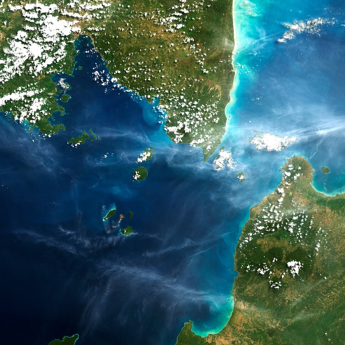
| Sunda Strait,satellite image. Satellite image showing the southern tip of the island of Java and the northern tip of the island of Sumatra in Southeast Asia. Vegetation is green,water is blue,and cloud is white. The stretch of water between the two islands is known as the Sunda Strait,which connects the Java Sea to the Indian Ocean. Imaged in August 2001 | |
| Licence : | Droits gérés |
| Crédit: | Science Photo Library / Planetobserver |
| Taille de l’image : | 4193 px × 4193 px |
| Model Release : | Non requis |
| Property Release : | Non requis |
| Restrictions : | - |
Prix pour cette image À partir de 45 €
Produit vendu
(Calendrier, Carte postale, Carte de vœux, Impression sur textile, Packaging etc)
À partir de 45 €
Usage commercial
(Affichage, Annonce presse, Annonce TV, Carte, Digital - hors rés. sociaux, Digital - rés. sociaux etc)
À partir de 45 €
Éditorial
(Digital, Journal, Livre, Livre pratique, Magazine, Télévision etc)
À partir de 60 €
Usage non-commercial
(Digital - hors rés. sociaux, Digital - rés. sociaux etc)
À partir de 120 €
Mots clés
- 21ème siècle,
- Asie,
- Asie du Sud-Est,
- d'en haut,
- de Sumatra,
- du haut,
- eau,
- géographie,
- géographique,
- géologie,
- géologique,
- île,
- îles,
- image satellite,
- Java,
- Javan,
- javanais,
- nuage,
- nuages,
- observation de la terre,
- océan,
- plongeant,
- satellite,
- sud-est asiatique,
- Sumatra,
- volcanique,
- vulcanologie,
- XX1ème siècle